

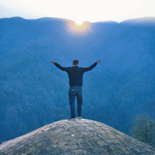
Near Eastern archaeologists have a word worth learning before the trip: tell. It is a hill, but not a natural one. For thousands of years people built a house of mudbrick, it collapsed, a new one was put up on the rubble, and over a hundred generations the settlement rose tens of metres above the plain. In Turkish such a hill is a höyük, hence Çatalhöyük and Alacahöyük; Troy is a tell too, just without the word in its name, and Göbekli Tepe is a hill of buried sanctuaries and the buildings around them. In each of them the layers lie one on top of another, the uppermost the youngest. The archaeologist enters the tell from above and takes off layer after layer until he reaches bedrock, the rock on which the first house stood.
Imagine that the whole history of Turkey is one such hill, and I am digging it from the top. On top is the republic we walk around in, under it the Ottomans, under them Byzantium, and so on down to the pillars near Şanlıurfa, raised by hunters who did not yet know farming. Each chapter is one layer: from what ended it to what started it, and its base is already the next layer. Layers do not lie neatly even in a real hill: Byzantium runs parallel to the Seljuks and the Ottomans, the Hittite splinters parallel to Lydia and Phrygia, so the dates in the headings are the boundaries of a layer, not walls between them. And geography does not match depth: the upper layers are best seen in Istanbul and Bursa, the Hittites and the Neolithic lie in the centre, between Çorum and Konya, the Greeks and Rome on the coast, and the bottom in the southeast, beneath Şanlıurfa and Diyarbakır.
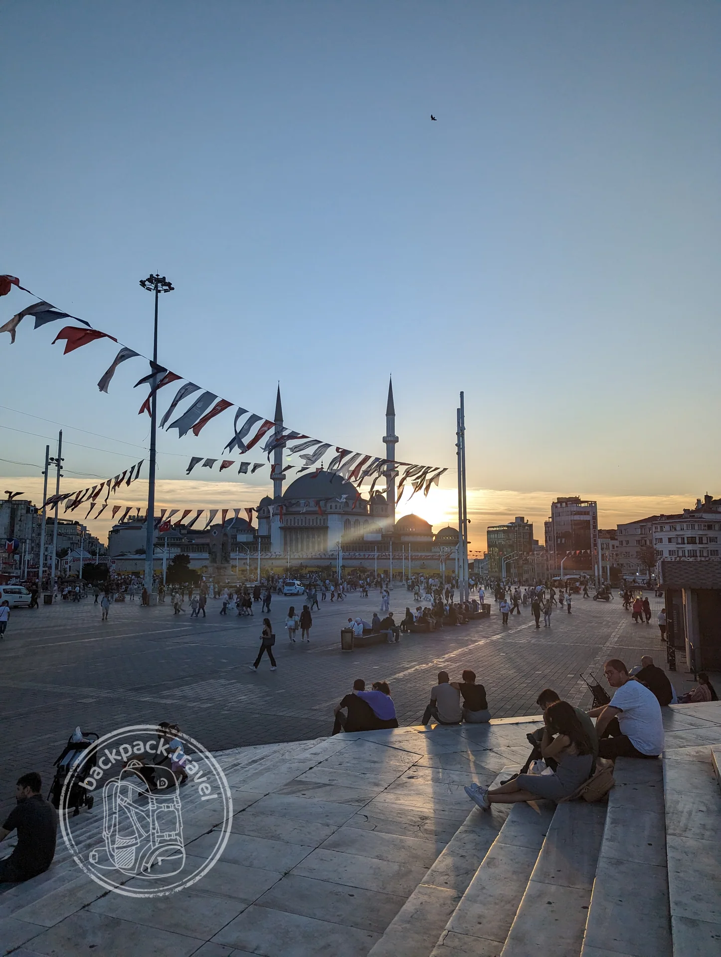
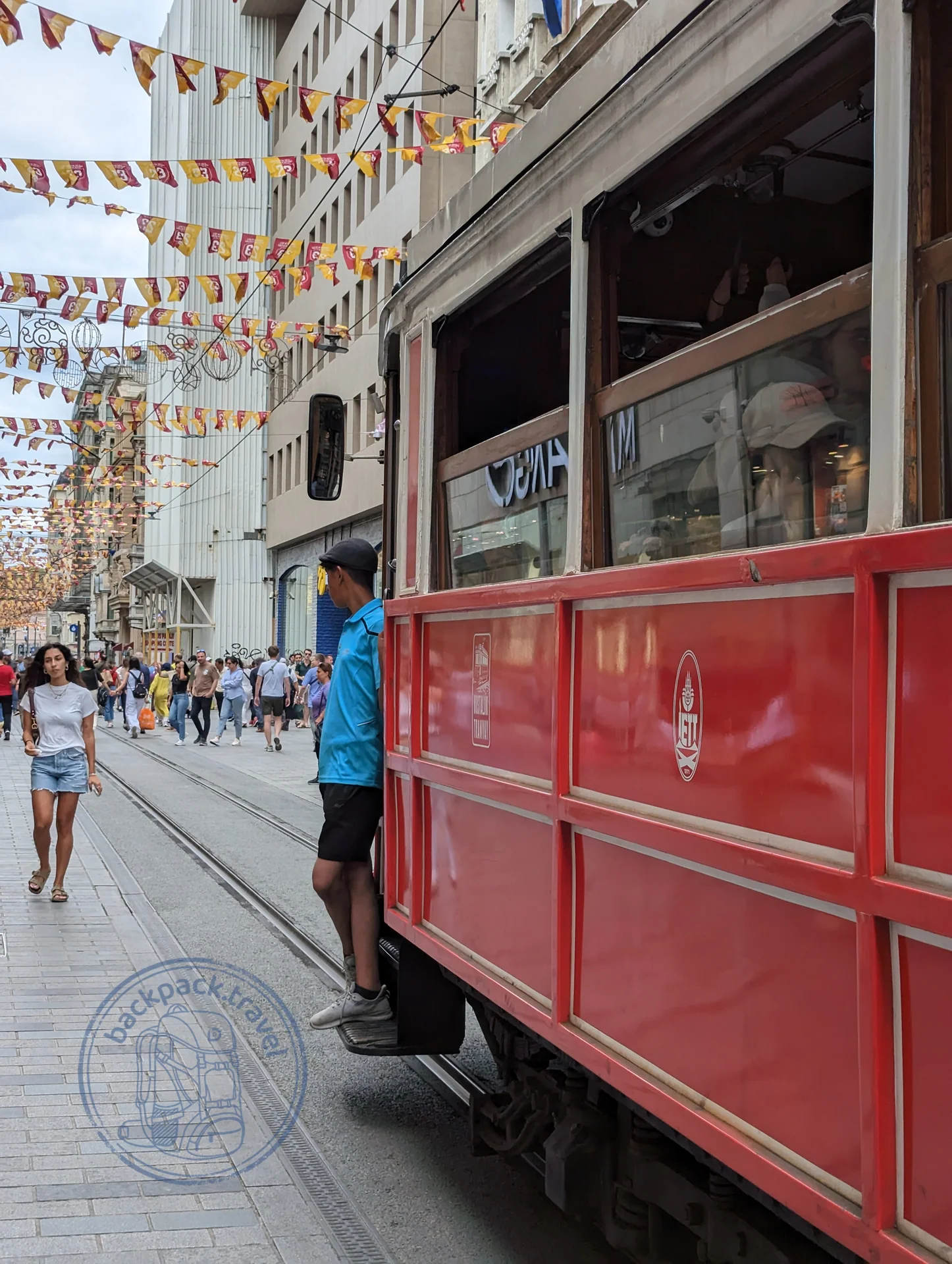
Today the layer of the republic is what people walk on: the Republic Monument on Taksim, İstiklal Avenue with its apartment blocks and a tram from the end of the nineteenth century, Sirkeci station, where the Orient Express ended. The centenary was marked in 2023, and that year Atatürk hung on every Turkish building.
Rewind. On 29 October 1923 the republic was proclaimed, and the capital was already in Ankara, not in Istanbul: further from the palaces, the straits and everything that recalled the sultans. In the summer of that year the Treaty of Lausanne fixed the borders and formalised the exchange of populations: about 1.2 million Orthodox Greeks left Anatolia, about 400 thousand Muslims came from Greece, and Greek Smyrna, burned down in September 1922, became Turkish İzmir. And before that came three years of the war of independence against the Treaty of Sèvres of 1920, under which Anatolia was to be cut apart.
The Ottoman Empire ended on 1 November 1922, when the Grand National Assembly abolished the sultanate. By then it had been losing provinces for seventy years and had lost the First World War, and with it Arabia, Iraq, Syria and Palestine. In that same war, in 1915, the Armenians of Anatolia were deported to the Syrian deserts, and most of them died; the Armenian houses of Mardin and the churches on Lake Van, which will turn up in the lower layers, have stood without Armenians ever since.
But what we see in Istanbul is the peak: the Blue Mosque of 1609–1617, set opposite Hagia Sophia in order to compete with it, Sinan's Süleymaniye of the 1550s, the Koza Han in Bursa of 1491, where silk cocoons were traded, Topkapı, founded six years after the conquest, the Grand Bazaar, which has been trading since the fifteenth century.
The last fragment of Byzantium in Anatolia, Trebizond, where the Grand Komnenoi sat for two hundred and fifty years after the Fourth Crusade, was taken by Mehmed II in 1461; the fortress on the rock above Trabzon is their building, the Ottomans only repaired it. The conquest of Constantinople itself came eight years earlier, on 29 May 1453, after 53 days of siege; the last emperor, by tradition, fell in the final fight, and his body was never identified.
Half a century before that the Ottomans were nearly wiped out: in 1402 near Ankara Timur defeated Bayezid I and took him prisoner, where he died eight months later, and the state fell apart into appanages for ten years. The Ulu Cami in Bursa with its twenty domes was finished by Bayezid in 1399, three years before the catastrophe. The Genoese, who held Galata as a colony, had by then already put up a tower above it half a century earlier, in 1348, and after 1453 simply changed their overlord. And before all of it there was Bursa, the first real capital, taken by Orhan in 1326: a city with a living bazaar. And the very beginning, 1299, Söğüt, the small beylik of Osman, one of dozens just like it, with only one difference: it sat right on the Byzantine border and grew at the expense of Byzantine Bithynia, and swallowed its Turkic neighbours only later.
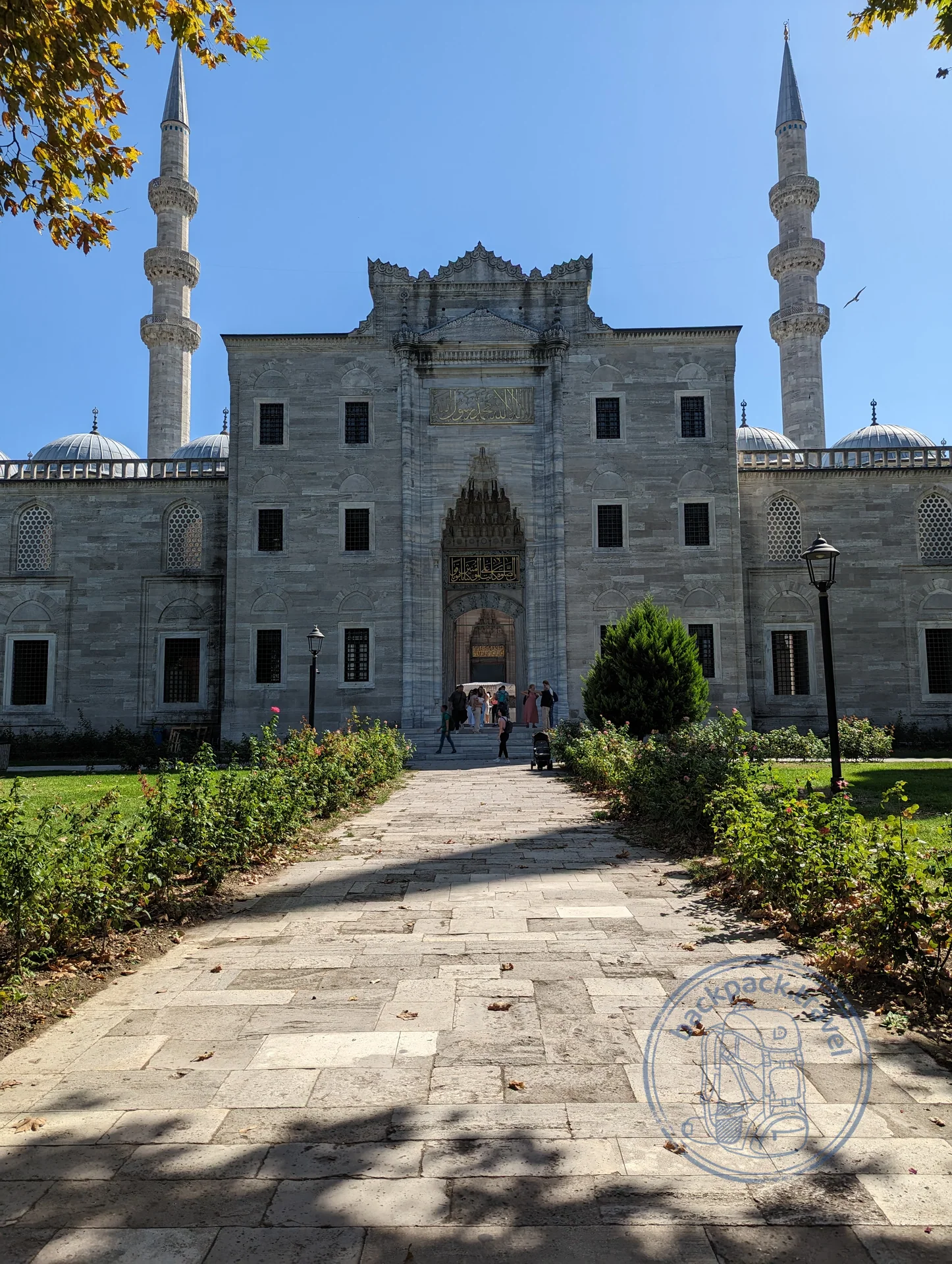
Süleymaniye Mosque
The Süleymaniye Mosque stands on the third hill of Istanbul and is considered the main work of Mimar Sinan in the capital itself.
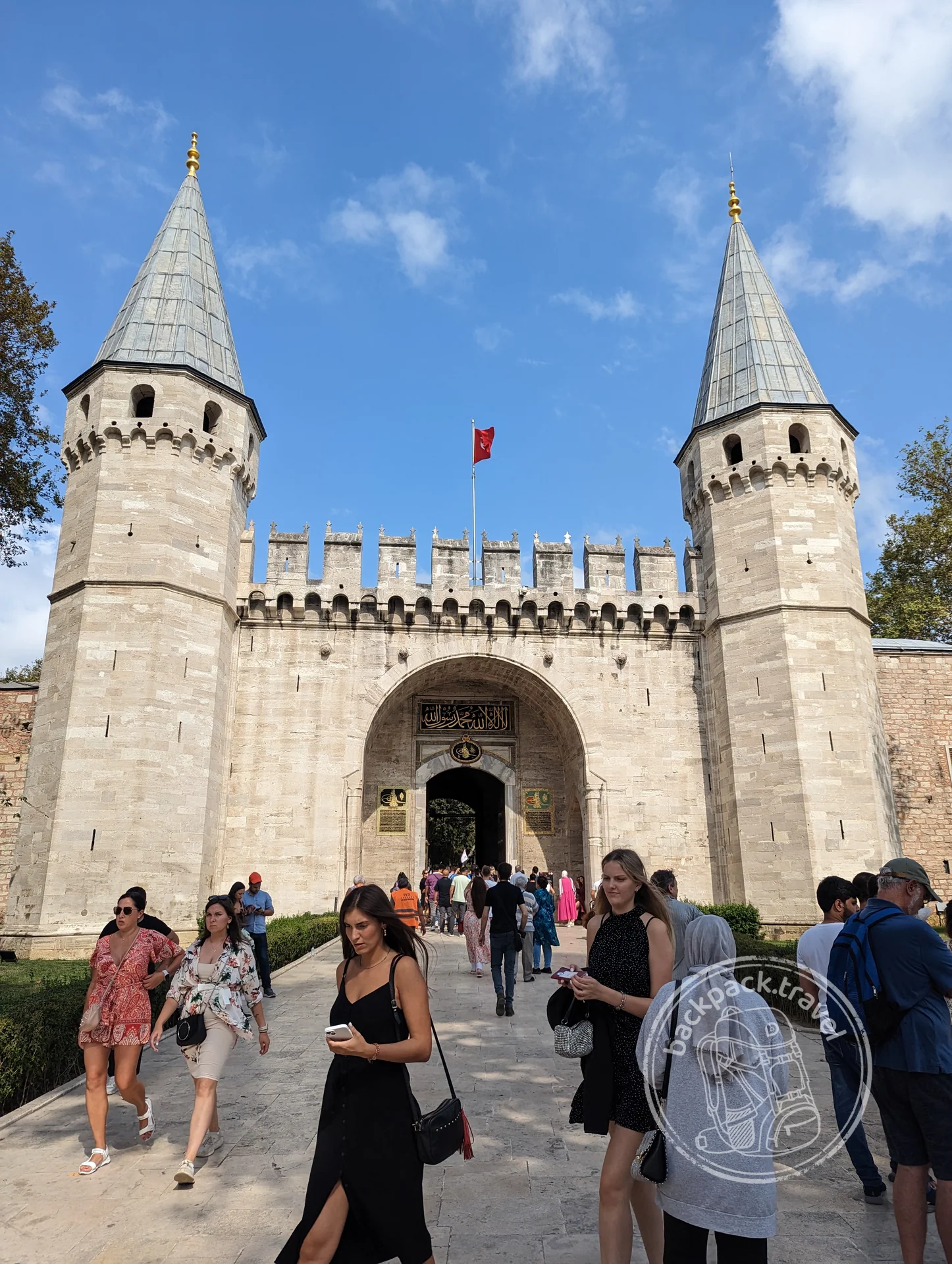
Topkapı Palace
Topkapı Palace was founded in the 1460s under Mehmed II on the promontory between the Sea of Marmara, the Bosphorus and the Golden Horn, and for almost four centuries it…
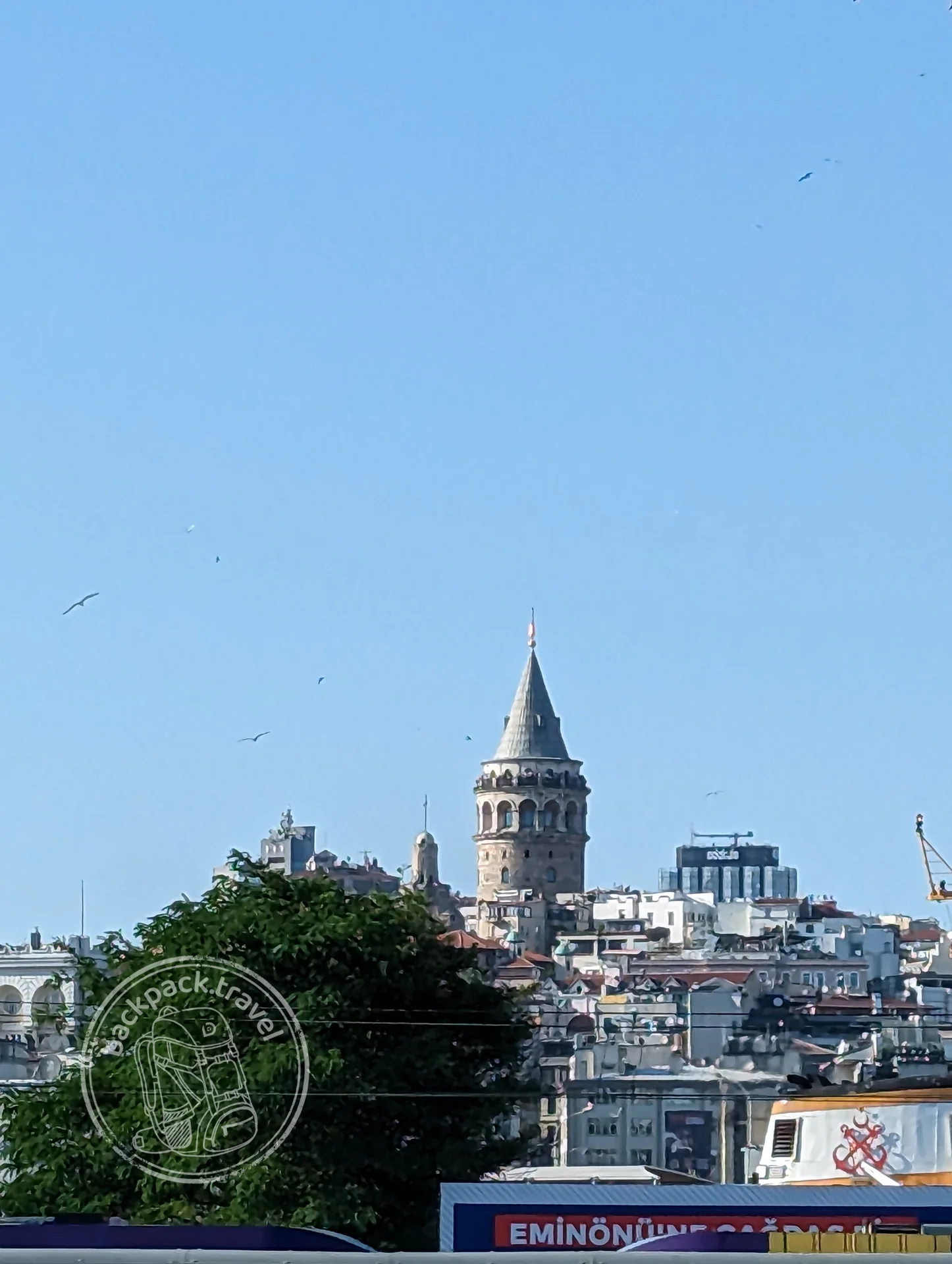
Galata Tower
The Galata Tower rises above the Karaköy quarter, on the hill of the Golden Horn shore opposite the old city.
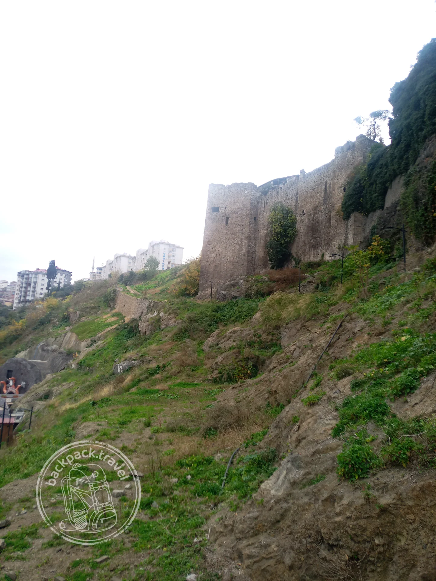
Trabzon Castle
The walls of Byzantine Trebizond run along the edge of a rocky ridge between two ravines and divide the old city into three parts — the upper citadel…
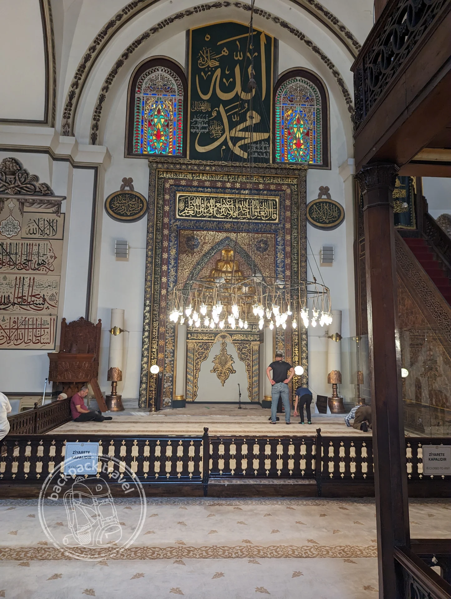
Ulu Cami Mosque in Bursa
The Great Mosque of Bursa, the Ulu Cami, was built in 1396–1399 under Sultan Bayezid I with the spoils taken at the Battle of Nicopolis.
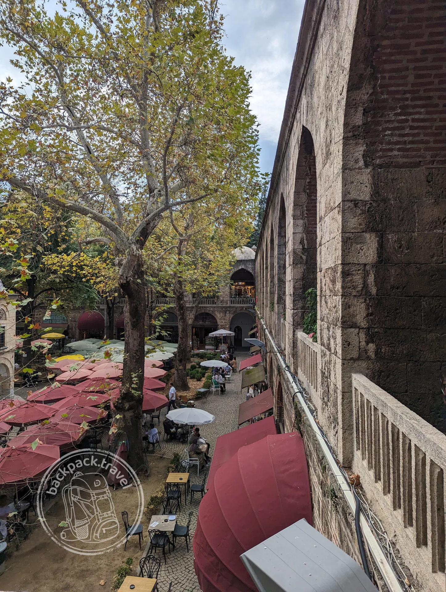
Koza Han
The Koza Han was built in 1490–1491 to the order of Sultan Bayezid II: the income from the caravanserai went to the upkeep of his mosque in Istanbul.
By 1308 nothing was left of the Sultanate of Rum but the name; formally it outlived the birth of the Ottoman beylik by nine years. Jalal ad-Din Rumi, the Persian poet, died in Konya in 1273, already in a vassal sultanate; his tomb under the green dome is today one of the main places of pilgrimage in the country. The Çifte Minareli Medrese in Erzurum, of the 1260s–1270s, the exact date disputed, two fluted minarets in turquoise tile, was also built under the Mongols: in 1243 at Köse Dağ they defeated the Seljuks, and from then on the Mongols installed and removed the sultans.
The flowering was short and falls in the 1220s–1230s: that was when the Alaeddin Mosque on the hill in Konya was being finished, and in the same decades caravanserais were set along the roads every thirty or forty kilometres, a caravan's day of travel apart, where a traveller stayed three days for free. These roads are the main Seljuk legacy. At Aspendos the Seljuks laid a bridge with steep ramps on the piers of a Roman bridge of the fourth century, and since some of the piers had slid downstream, the spans had to be run in a zigzag. One layer lies on another literally, and you can walk across it.
Under the Seljuks the peninsula was not only Turkic: from 1098 to 1144 the crusaders sat in Edessa, today's Şanlıurfa, and their first state in the East appeared before the one in Jerusalem. Konya, ancient Iconium, became the capital of the sultanate in 1097, after the Byzantines with the help of the crusaders took Nicaea back. And the first capital, from 1077, was Nicaea itself, a hundred kilometres from Constantinople: the Turks got there in six years after a single battle.
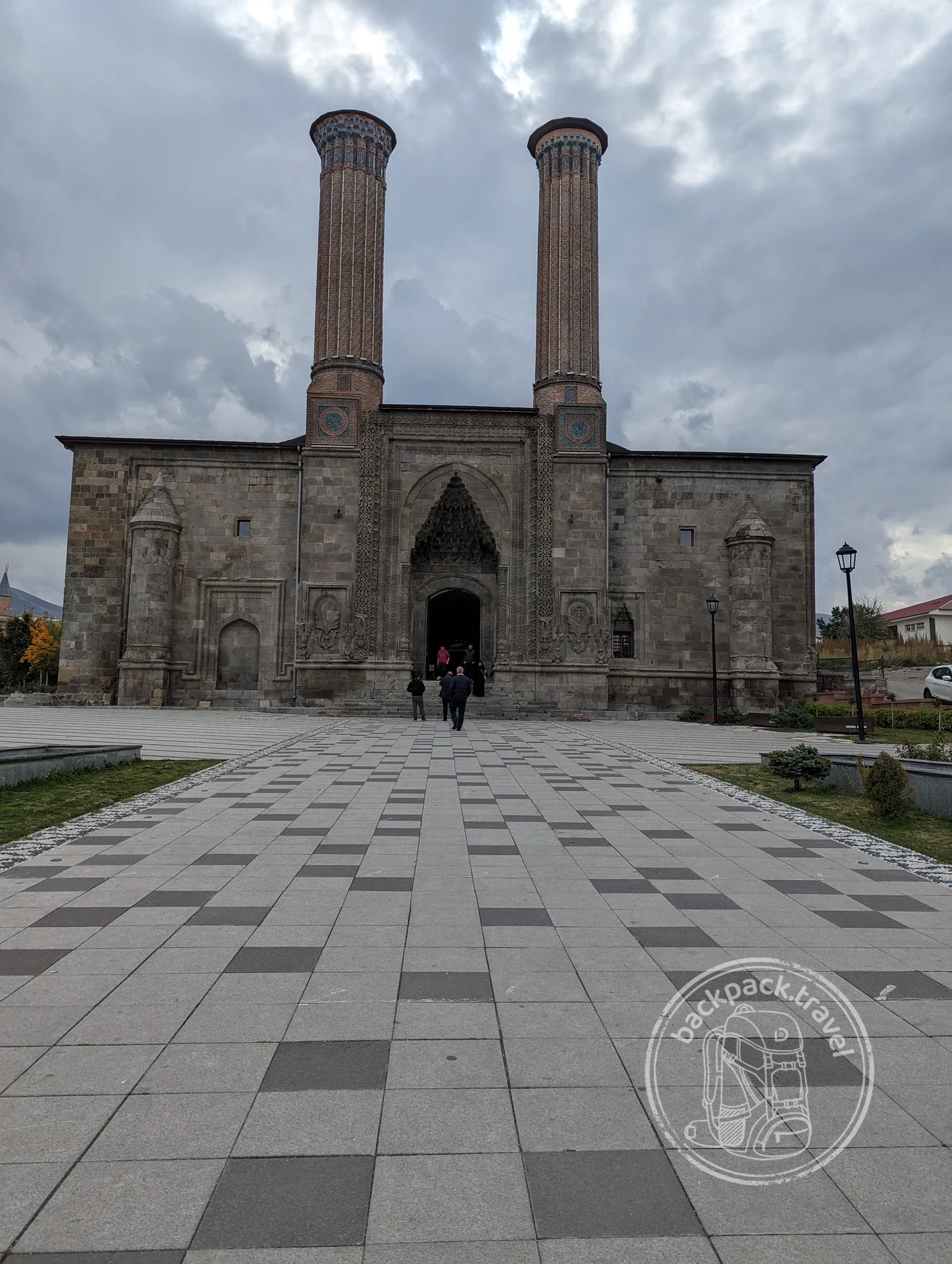
Çifte Minareli Medrese
A religious school of the late thirteenth century, the best-known building in Erzurum and one of the largest monuments of Seljuk architecture in…
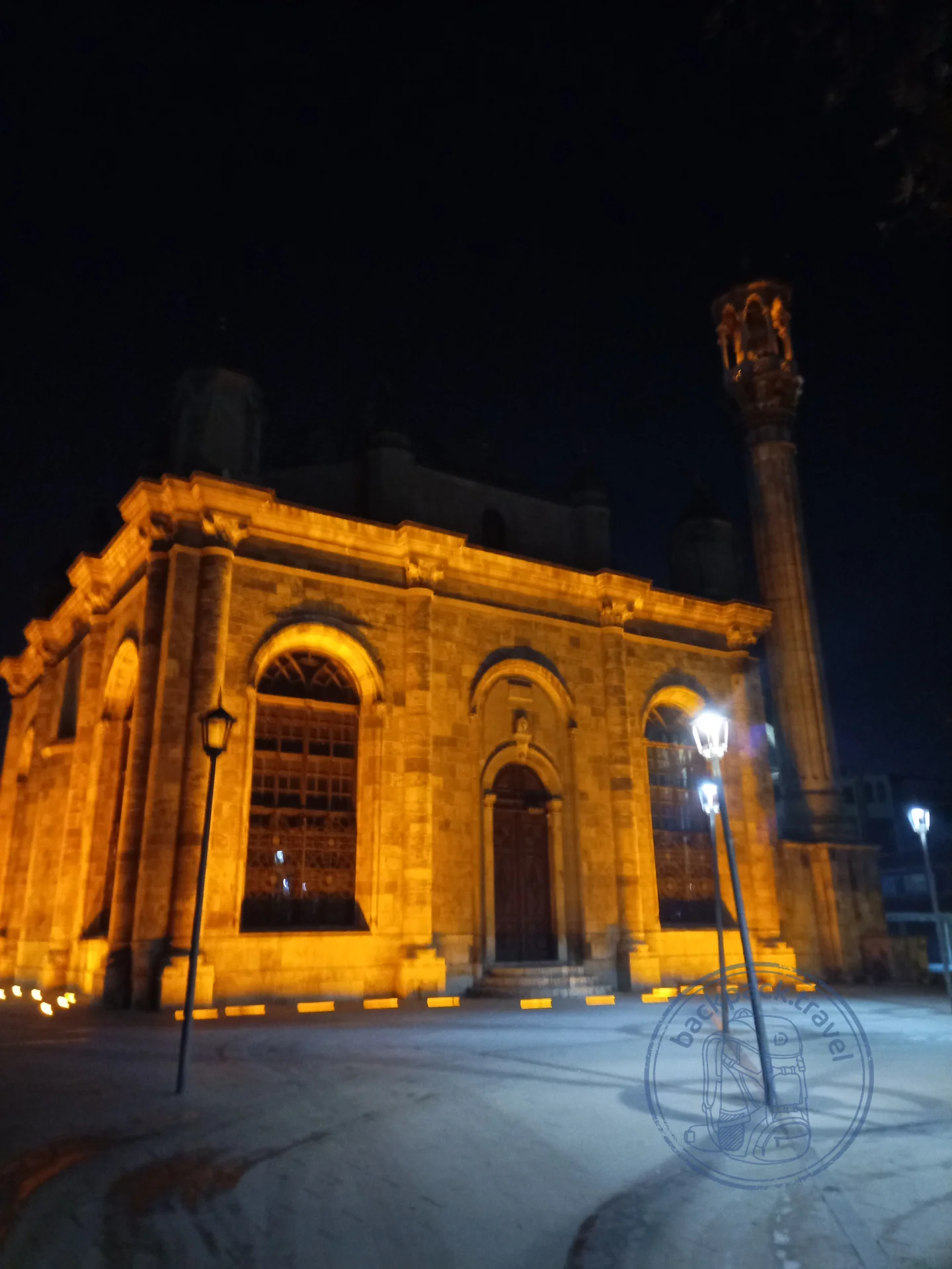
Alaeddin Mosque in Konya
The oldest congregational mosque in Konya occupies the top of the Alaeddin Tepe hill — an artificial mound in the very centre of the city, under which archaeologists…
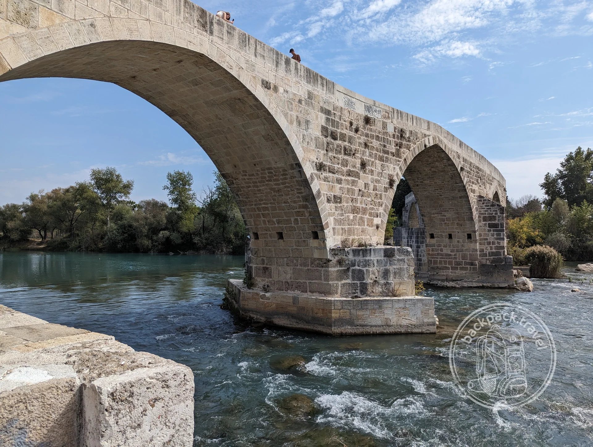
Eurymedon Bridge
A humpback bridge over the Köprüçay river, known in antiquity as the Eurymedon, a couple of kilometres from Aspendos.
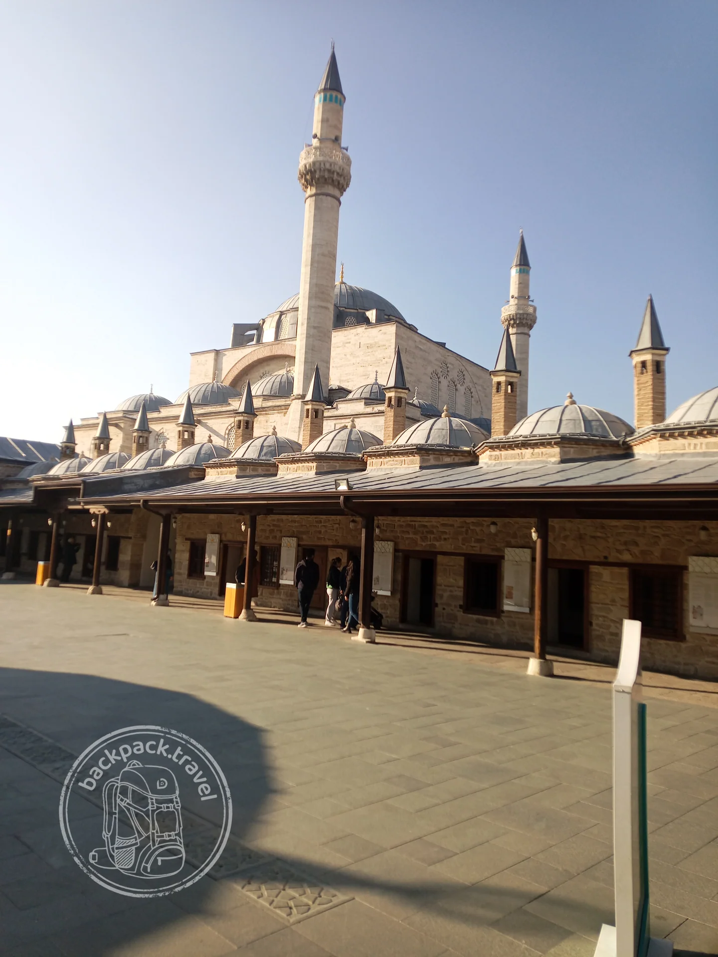
Mevlana Museum
The mausoleum of the poet and mystic Jalal ad-Din Rumi, known as Mevlana, — the main shrine of Konya and one of the most visited places in Turkey.
This layer begins higher than the previous one: Byzantium outlived the Seljuks and ended only in 1453, when what was left of it was a city with its suburbs. In the twelfth century the Komnenoi still held the coast, but after Manzikert the plateau was Turkic. Ani, the city of a thousand churches by today's Armenian border, was stormed by Alp Arslan in 1064 after 25 days of siege, and Byzantium had annexed it only twenty years before that, in 1045. The east had been patchwork even earlier, and not all of it Byzantine: the Armenian Bagratids in Ani and Kars, the kingdom of Vaspurakan with the church of Akdamar of 915 on an island in Lake Van, with David and Goliath on its outer walls, the Syriac Christians of Tur Abdin, who hold services in Aramaic to this day.
Cappadocia is Byzantium too: the frescoes of the tenth to twelfth centuries in Göreme and fourteen kilometres of cave churches in the Ihlara valley. And beneath them a grimmer layer. In the seventh to tenth centuries, when Arab raids reached the centre of the peninsula, whole villages went underground. Derinkuyu and Kaymaklı were enlarged by the Byzantines: in Derinkuyu eight levels are open, 85 metres down, with stables, a winery and millstone doors that closed only from the inside.
The peak of the layer is Justinian. In 562 the present dome, 31 metres across, was raised over Hagia Sophia, after the first one collapsed twenty years after the consecration; since then the dome has partly fallen twice, in 989 and 1346, and both times it was put back together. Hagia Sophia itself was built in 532–537, in five years and ten months, and at the same time the Basilica Cistern was dug beneath the square on 336 columns taken from ancient ruins. In 505, a generation before Justinian, Emperor Anastasius built the fortress of Dara against the Persians, and its walls stick out of a field ten kilometres from the Syrian border, near Mardin. Old Mardin is Syriac and Armenian houses lived in by Kurds and Arabs; above it Deyrulzafaran, a fifth-century monastery, and in Tur Abdin to the east Mor Gabriel of 397, one of the oldest working monasteries in the world. In 395 the empire split in two, and in 330 Constantine founded the capital on the site of Greek Byzantion.
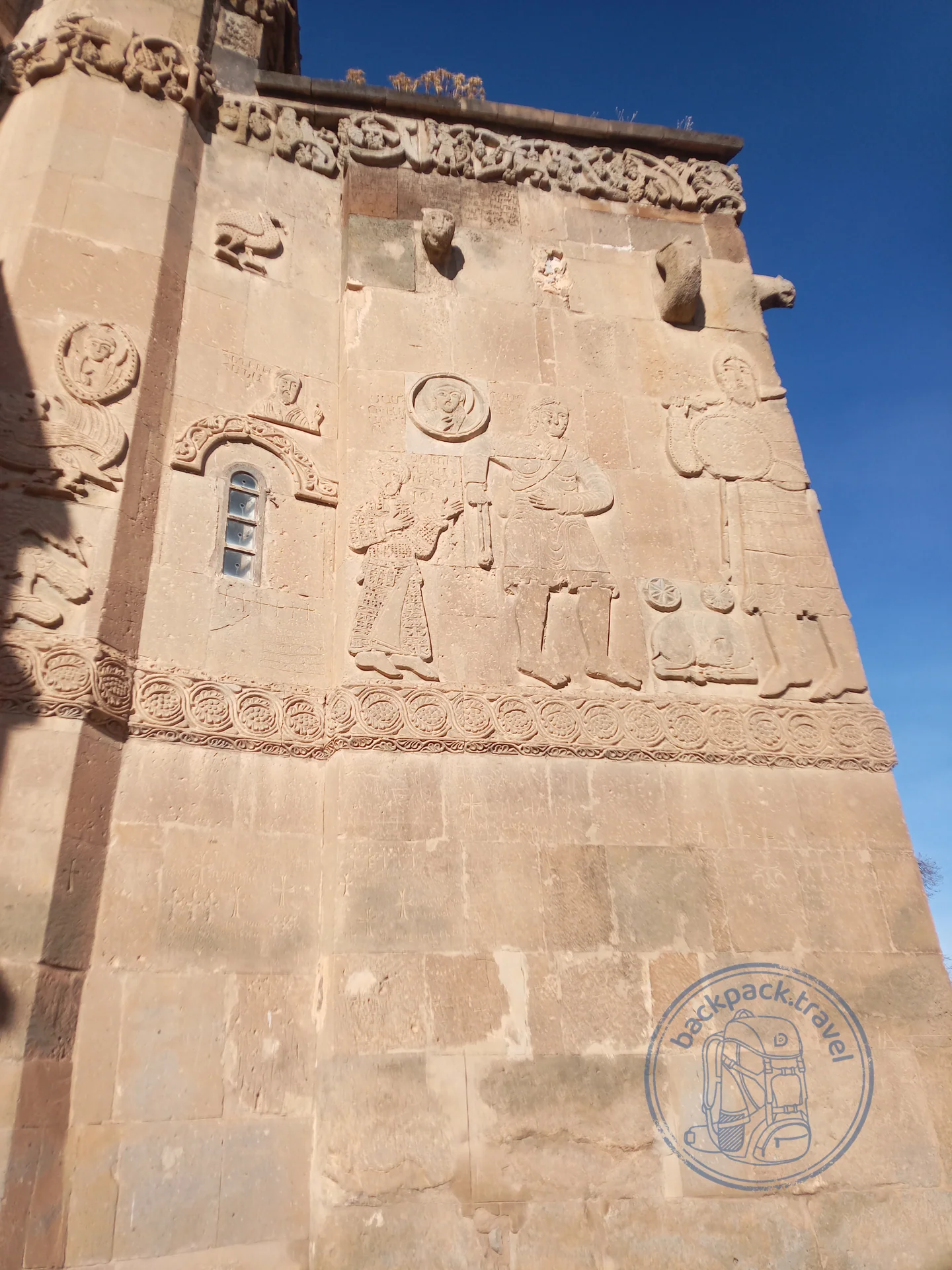
Church of the Holy Cross on Akdamar Island
The Church of the Holy Cross on Akdamar Island — a masterpiece of medieval Armenian architecture, built in 915–921 by the architect Manuel for…
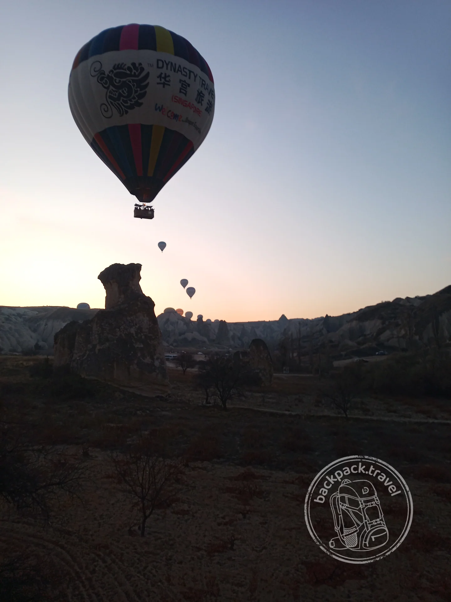
Göreme National Park
Göreme National Park — a valley in the heart of Cappadocia where volcanic tuff has weathered into cones, ridges and “fairy chimneys”.
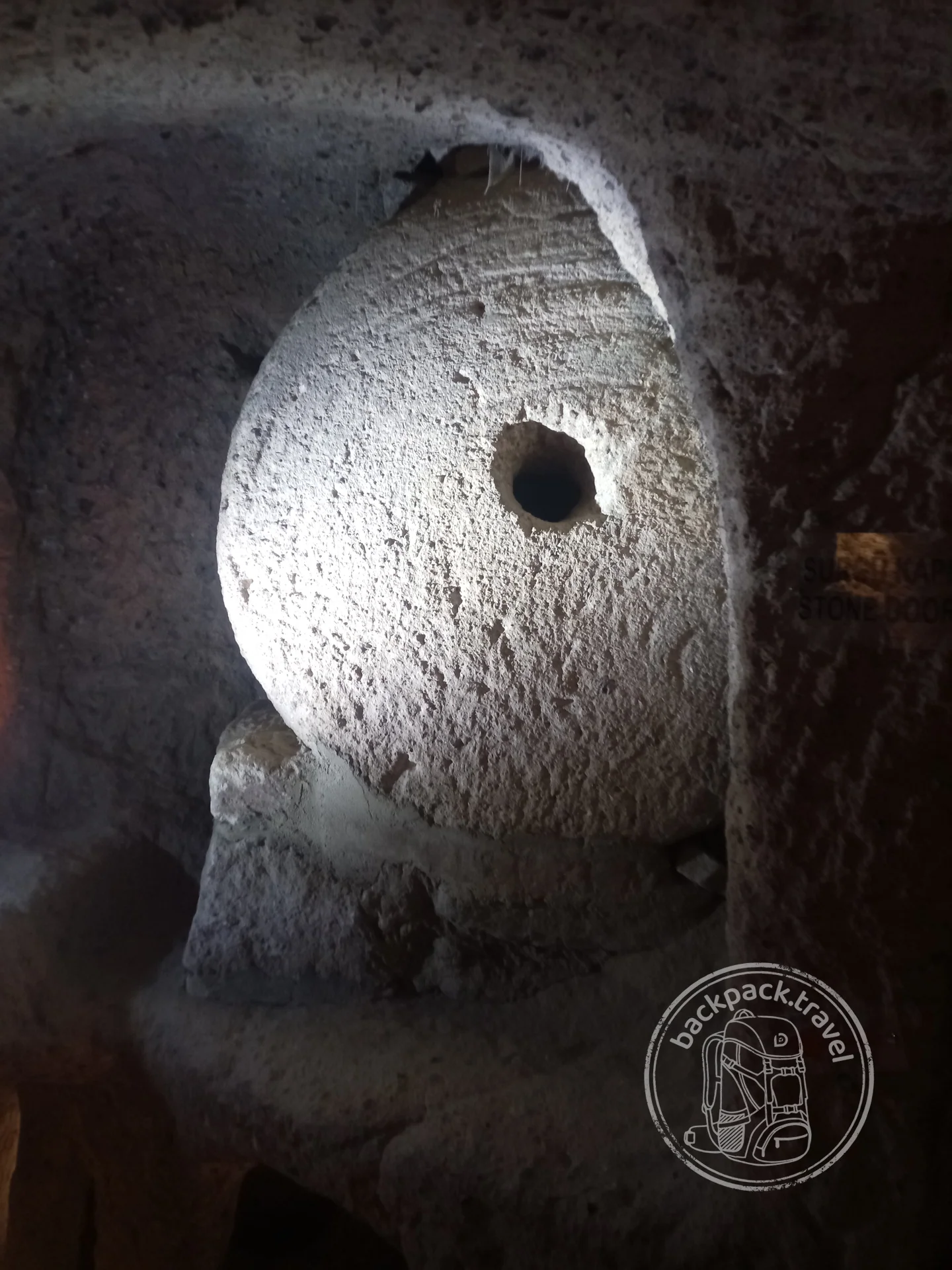
Derinkuyu Underground City
Derinkuyu — the deepest of the excavated underground cities of Cappadocia: the galleries go about eighty-five metres underground…
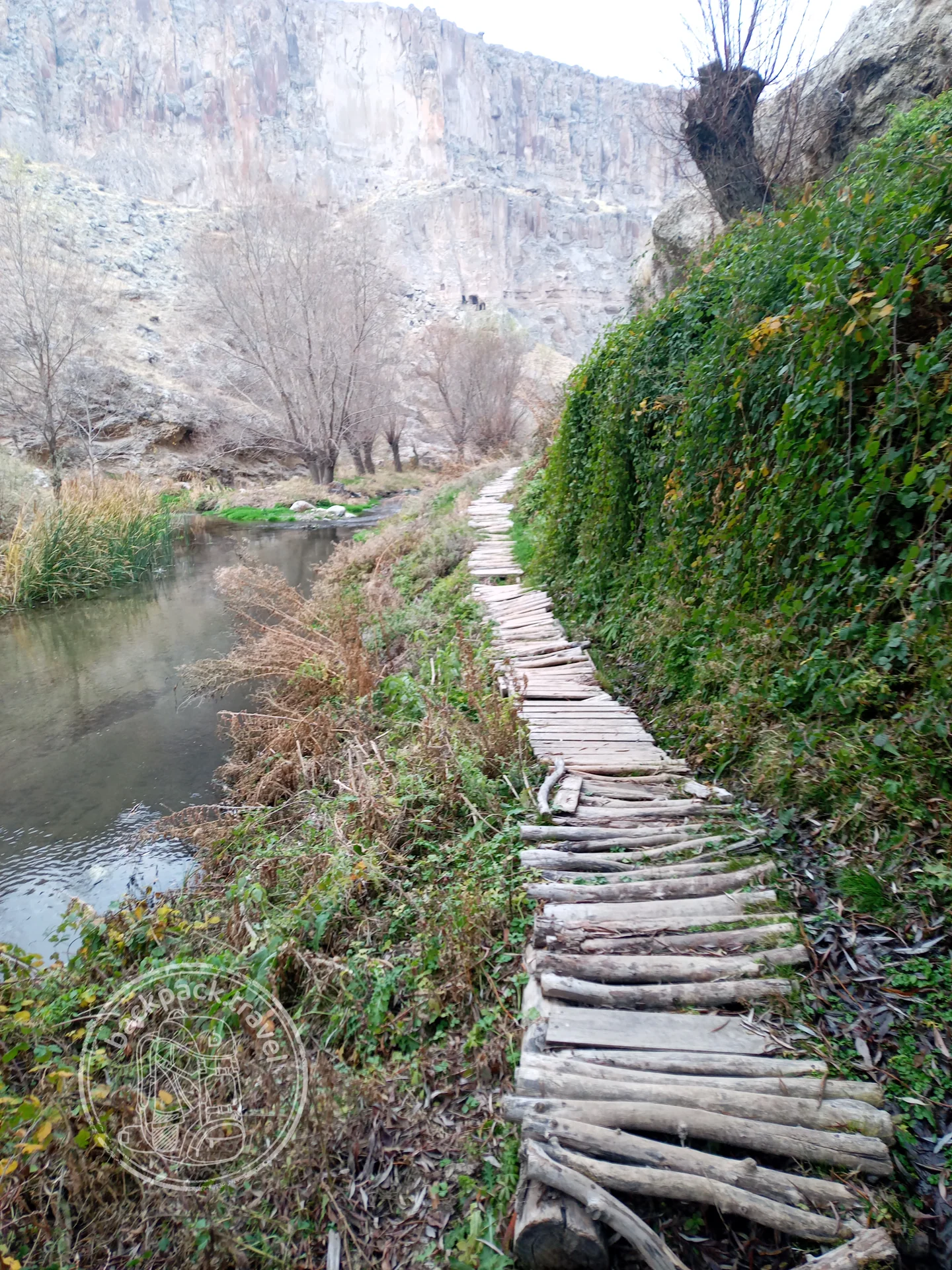
Ihlara Valley
Ihlara — a fourteen-kilometre canyon in the southwest of Cappadocia, cut by the Melendiz river into volcanic tuff to a depth of up to a hundred…
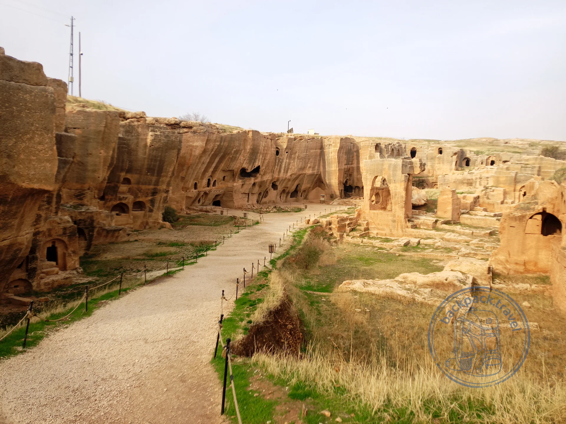
Ancient City of Dara
Dara, also known as Anastasiopolis, — the eastern outpost of Byzantium, built by Emperor Anastasius around 505 as a counterweight to the Persian…
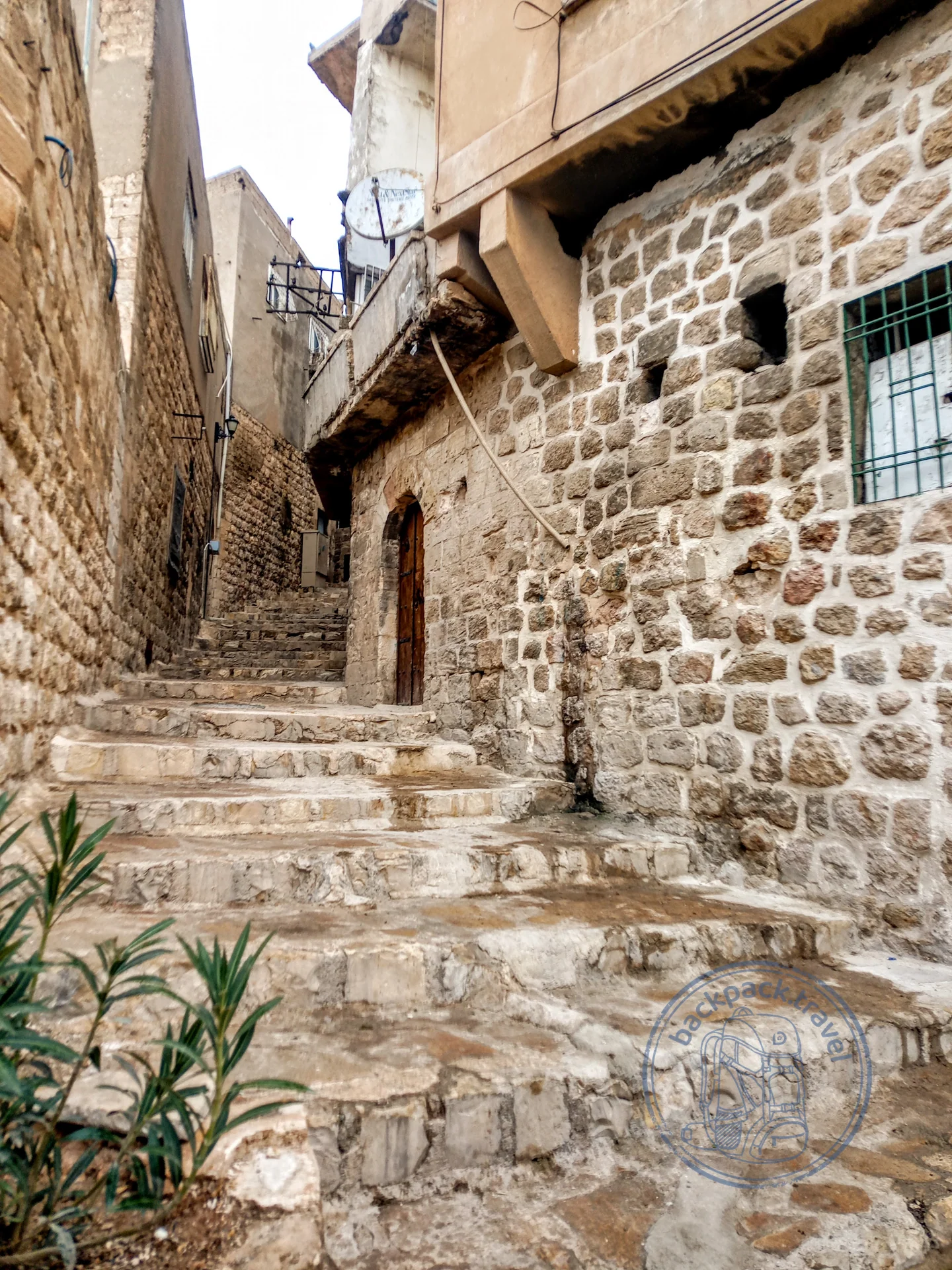
Old Town of Mardin
Old Mardin — a stone amphitheatre on a mountain slope above the Mesopotamian plain: the streets run in tiers, houses of golden limestone stand one…
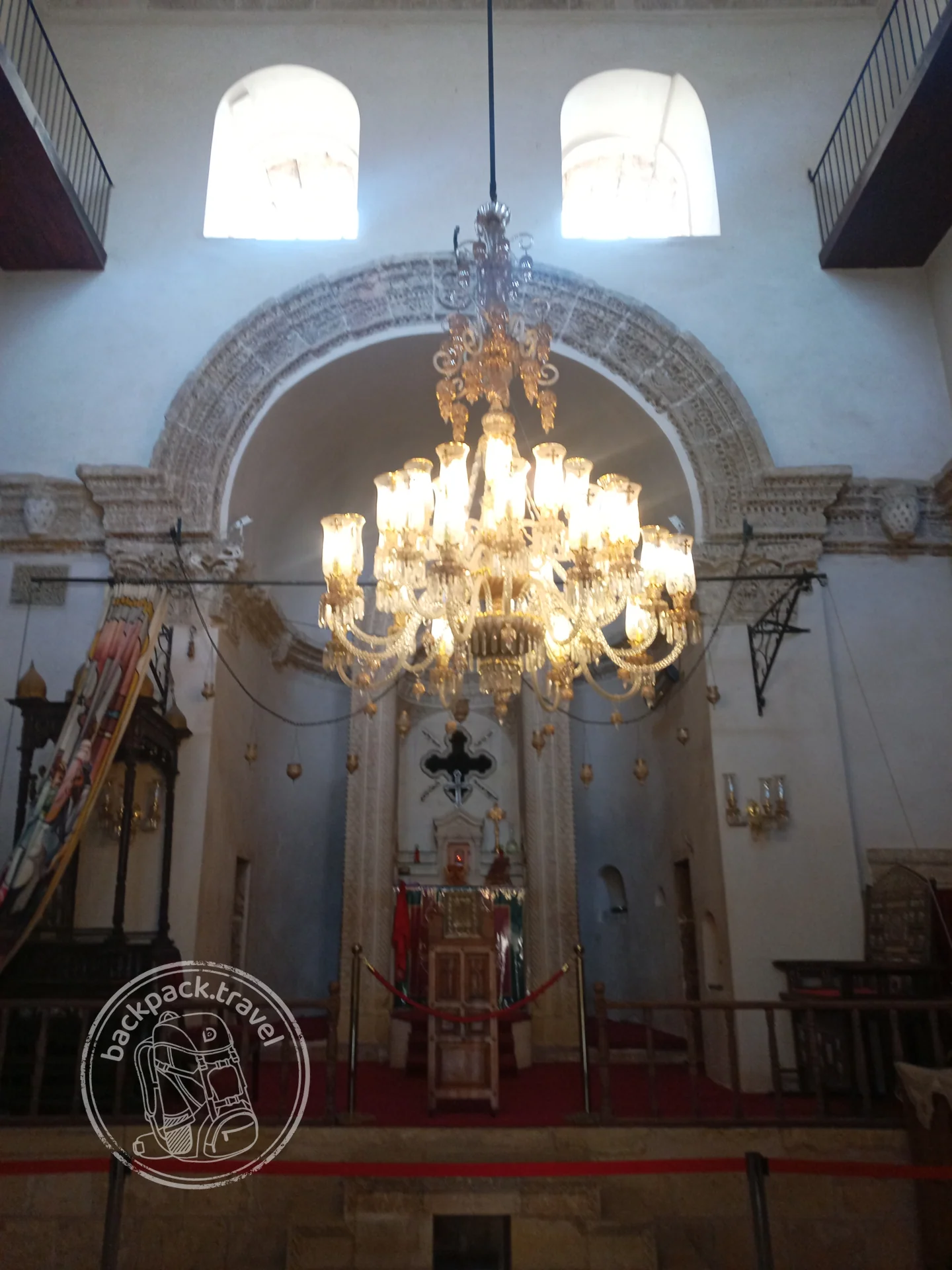
Deyrulzafaran Monastery
Deyrulzafaran, the “saffron monastery”, — the spiritual centre of the Syriac Orthodox Church, founded in the fifth century on the site of an even older…
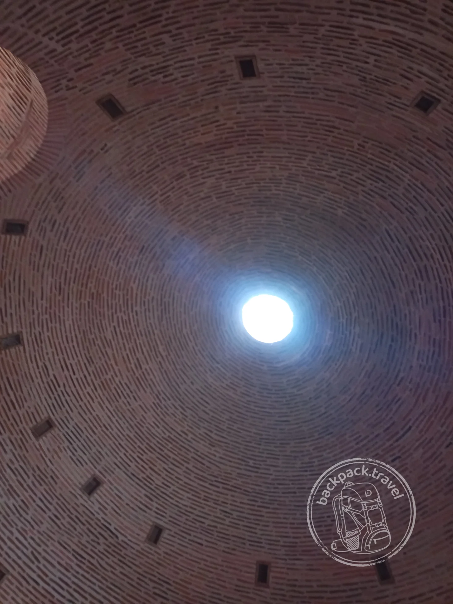
Mor Gabriel Monastery
Mor Gabriel, or Deyrulumur, — the oldest working Syriac Orthodox monastery in the world: it was founded in 397 and since then has never once…
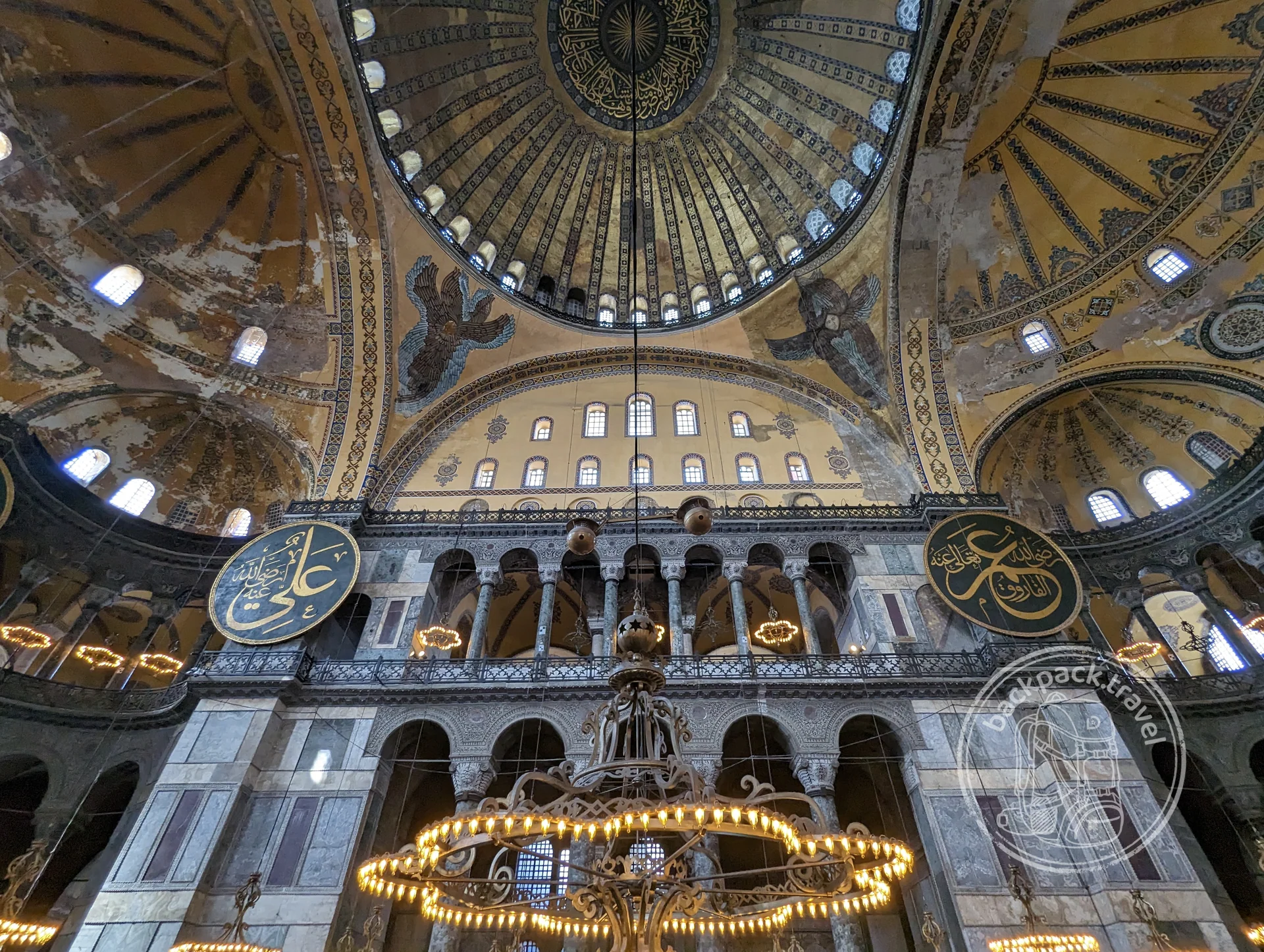
Hagia Sophia
Hagia Sophia was built in 532–537 by order of Emperor Justinian: in five years Anthemius of Tralles and Isidore of Miletus raised a dome…
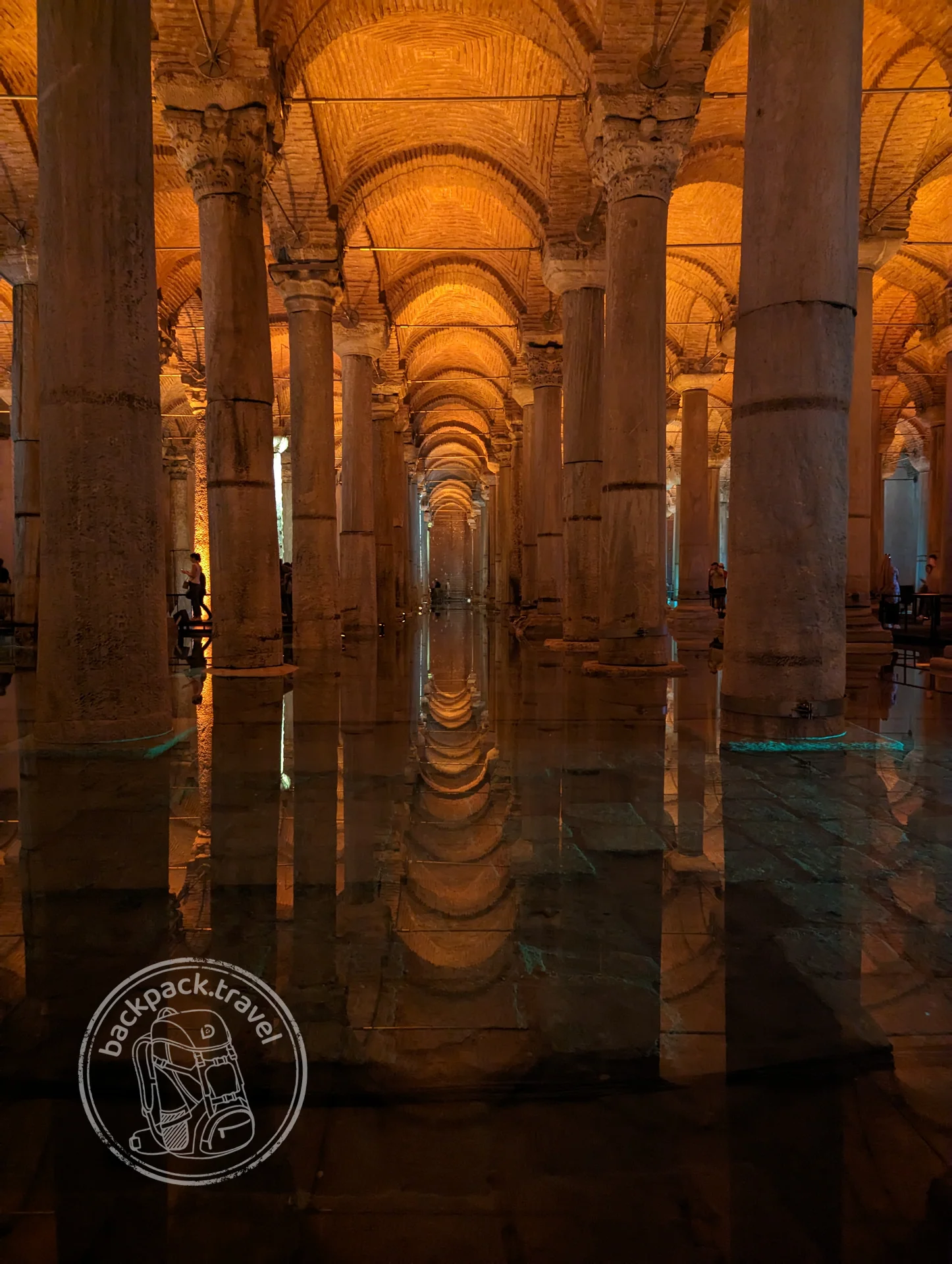
Basilica Cistern
The Basilica Cistern — the largest of the underground reservoirs of Byzantine Constantinople.
Roman Anatolia did not end, it moved along with the capital, and for three centuries before that it had been the richest part of the empire. Most of what is called “ancient Turkey” was built under the Romans, not under the Greeks.
On the coast between Perge and Olympos there are more than a dozen ancient cities, and the brown signs with their names come up on the road more often than signs to living villages. The most intact theatre is at Aspendos: second century, preserved together with its stage wall, which is rare for an ancient theatre, and concerts are given in it. There is a great deal of restoration there, and that is no misfortune: Aspendos is a rare theatre on the coast that reads as a building and not as a ruin. At Myra, beneath the Lycian tombs, there is a Roman theatre too, with stone masks of tragedy and comedy at the entrance, and at Smyrna beneath present-day İzmir the Roman agora has been excavated. The Library of Celsus in Ephesus was built around 117 by a son in memory of his father; the theatre for 25 thousand is there as well. Hierapolis stands on the travertines of Pamukkale, and the ancient pool with its fallen columns is still filled by the same hot spring. Laodicea is ten kilometres away, the city from the Book of Revelation, “neither cold nor hot”, excavated only over the last twenty years and almost empty.
Rome assembled the peninsula piece by piece: Commagene was annexed by Vespasian in 72, Lycia by Claudius in 43, Galatia by Augustus in 25 BC, Pontus by Pompey after three wars with Mithridates. The province of Asia appeared in 129 BC with its centre in Pergamon, and Ephesus became its capital under Augustus. And it all began in 133, when the last king of Pergamon, Attalus III, bequeathed his kingdom to Rome: Rome took Anatolia not so much by war as by inheritance and treaties.
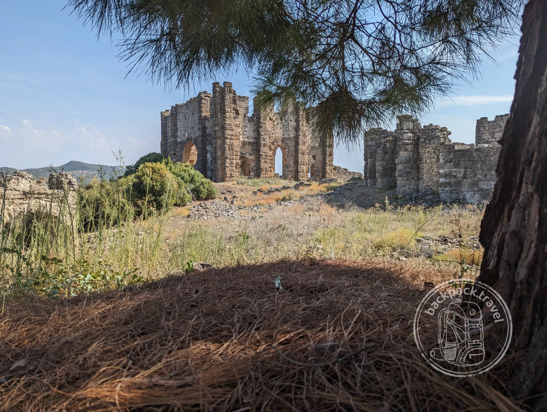
Upper City of Aspendos
While the tourist buses stand by the famous theatre, the hill above it is usually empty, although the city itself lay precisely there.
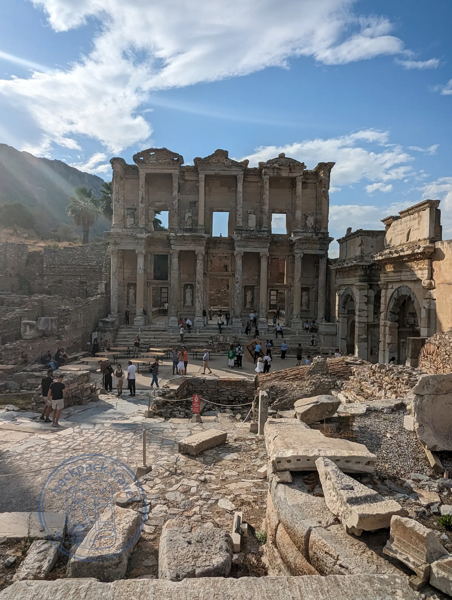
Library of Celsus
The Library of Celsus in Ephesus was built around the year one hundred and seventeen by the consul Gaius Julius Aquila in memory of his father, Tiberius Julius Celsus Polemaeanus…
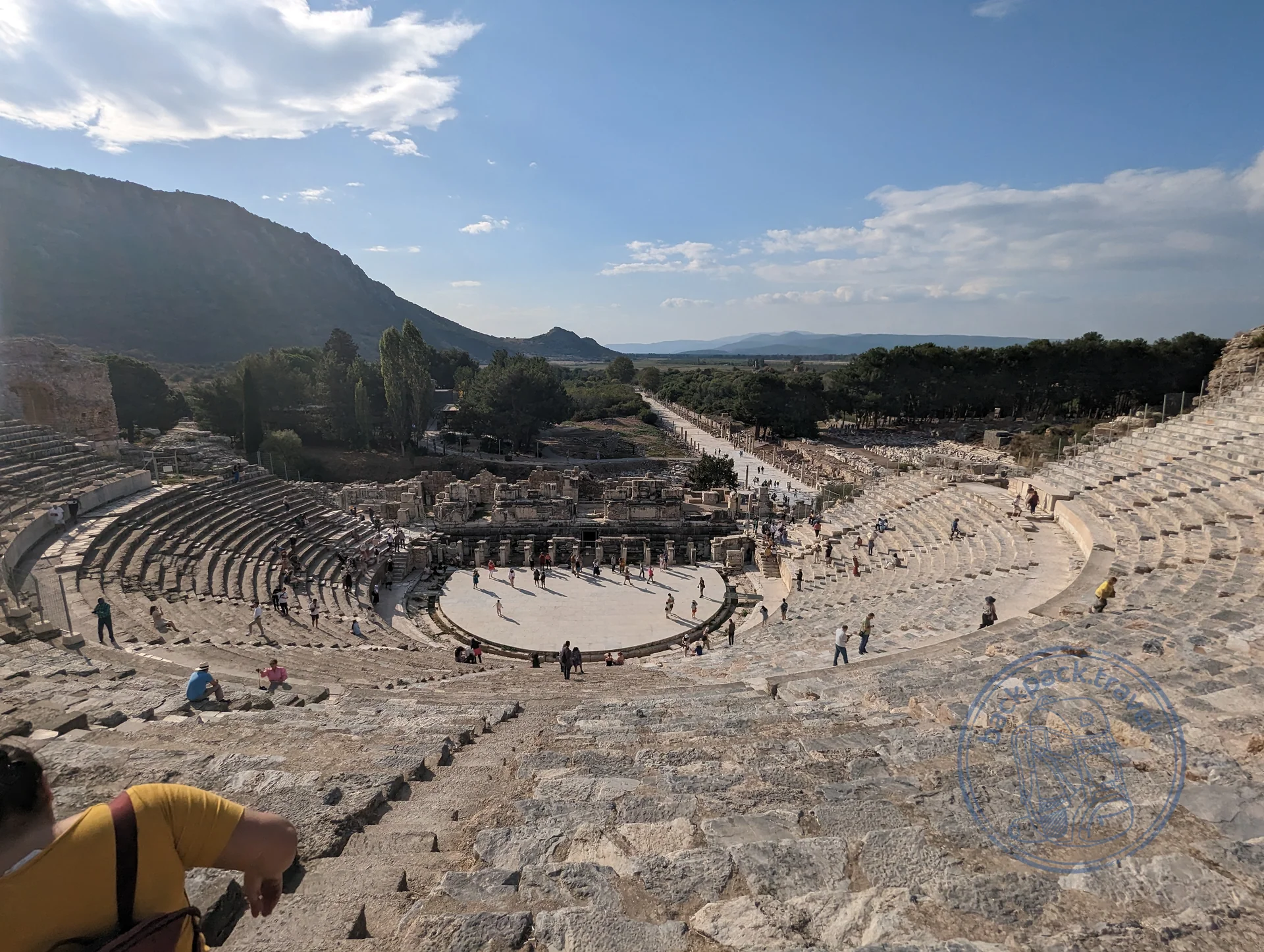
Great Theatre of Ephesus
The Great Theatre of Ephesus is cut into the western slope of Mount Panayır and remains the largest ancient theatre in Asia Minor.
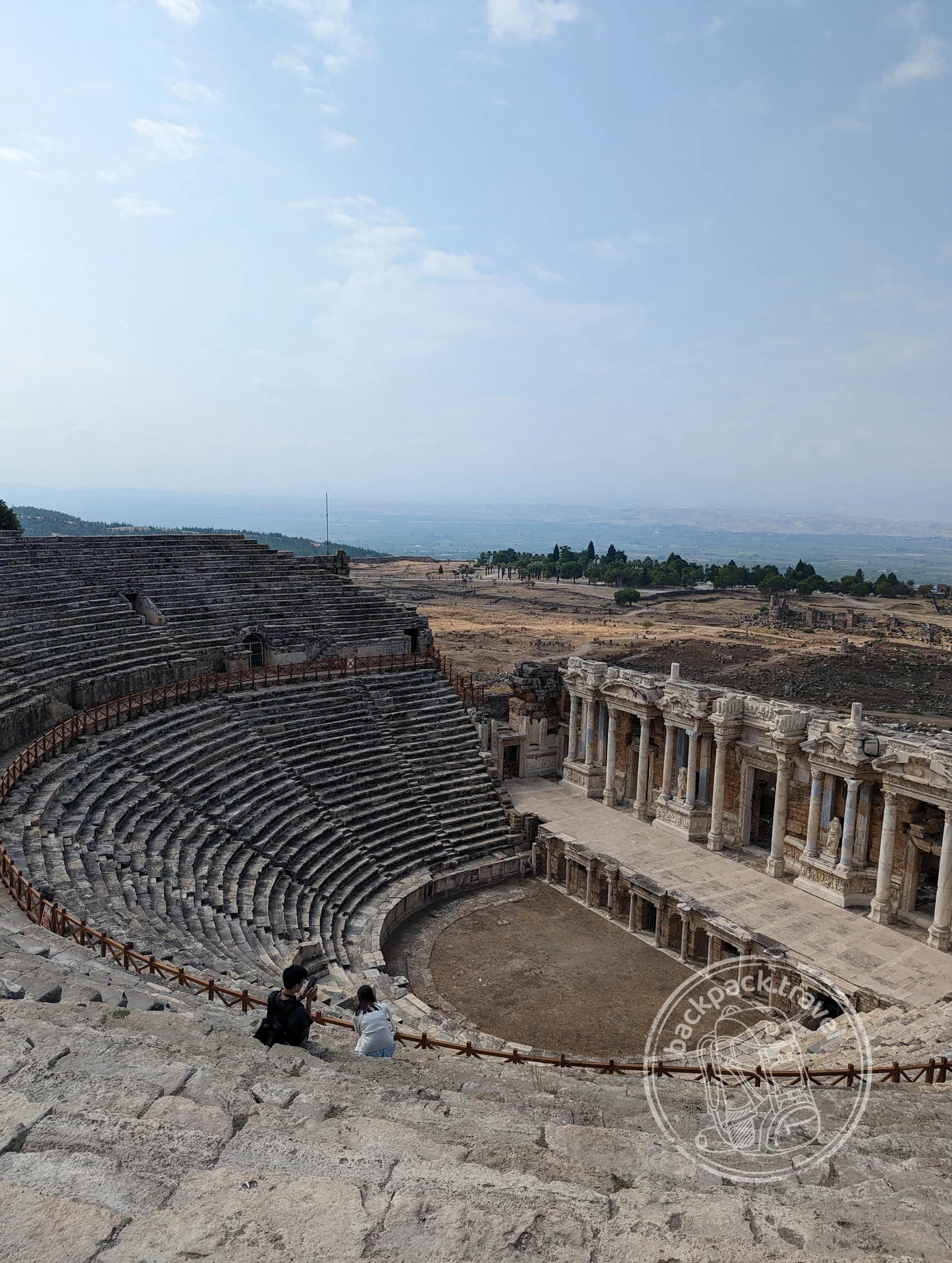
Hierapolis
Hierapolis was founded at the beginning of the second century BC by the kings of Pergamon at the hot springs that come out at the edge of the plateau above the Lycus valley.
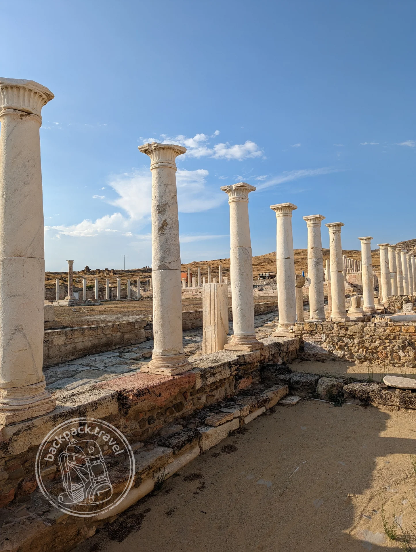
Ancient City of Laodicea
Laodicea on the Lycus was founded in the middle of the third century BC by Antiochus II and named after his wife Laodice.
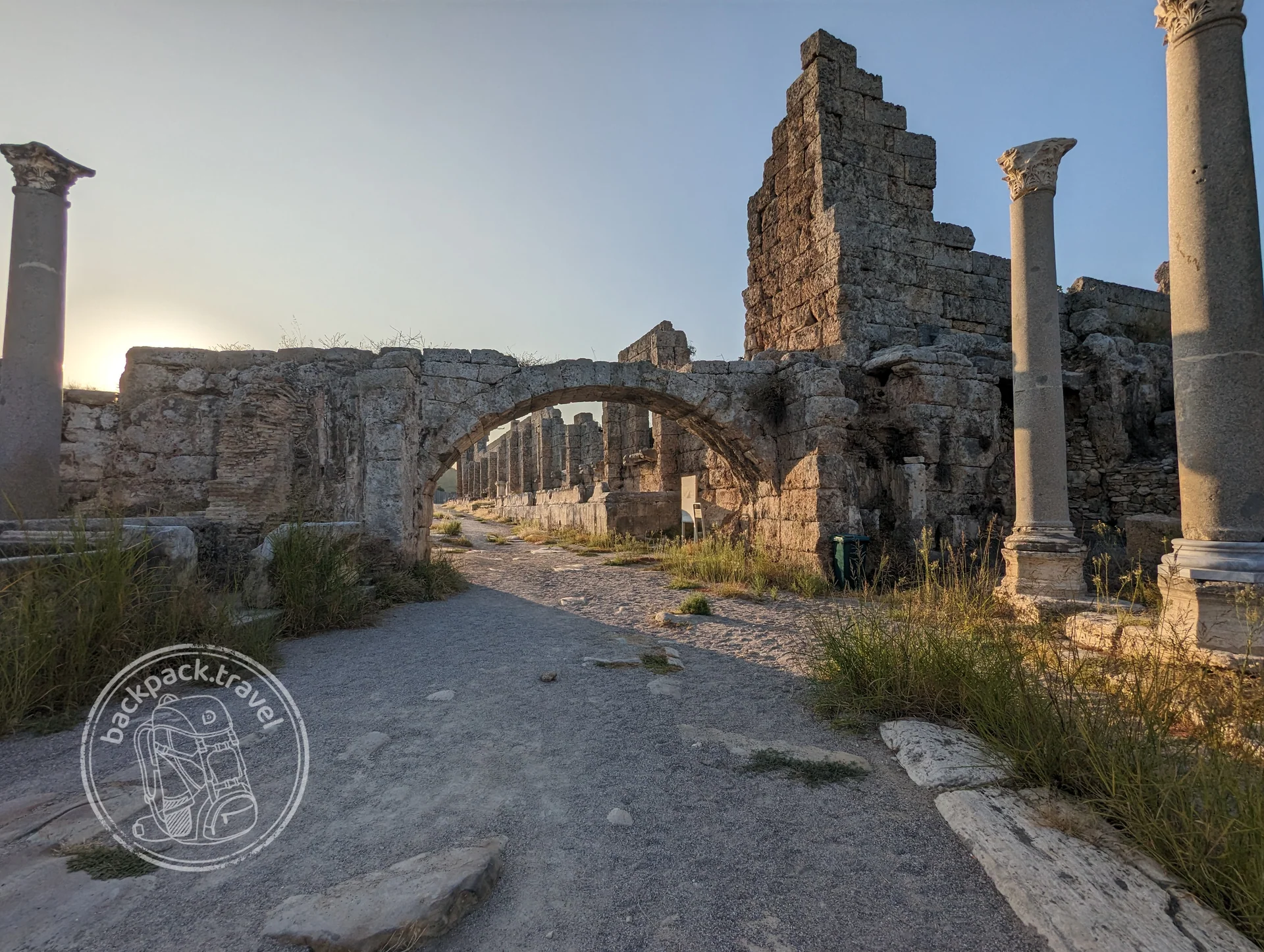
Ancient City of Perge
One of the largest and most readable ancient cities of Pamphylia, eighteen kilometres east of Antalya.
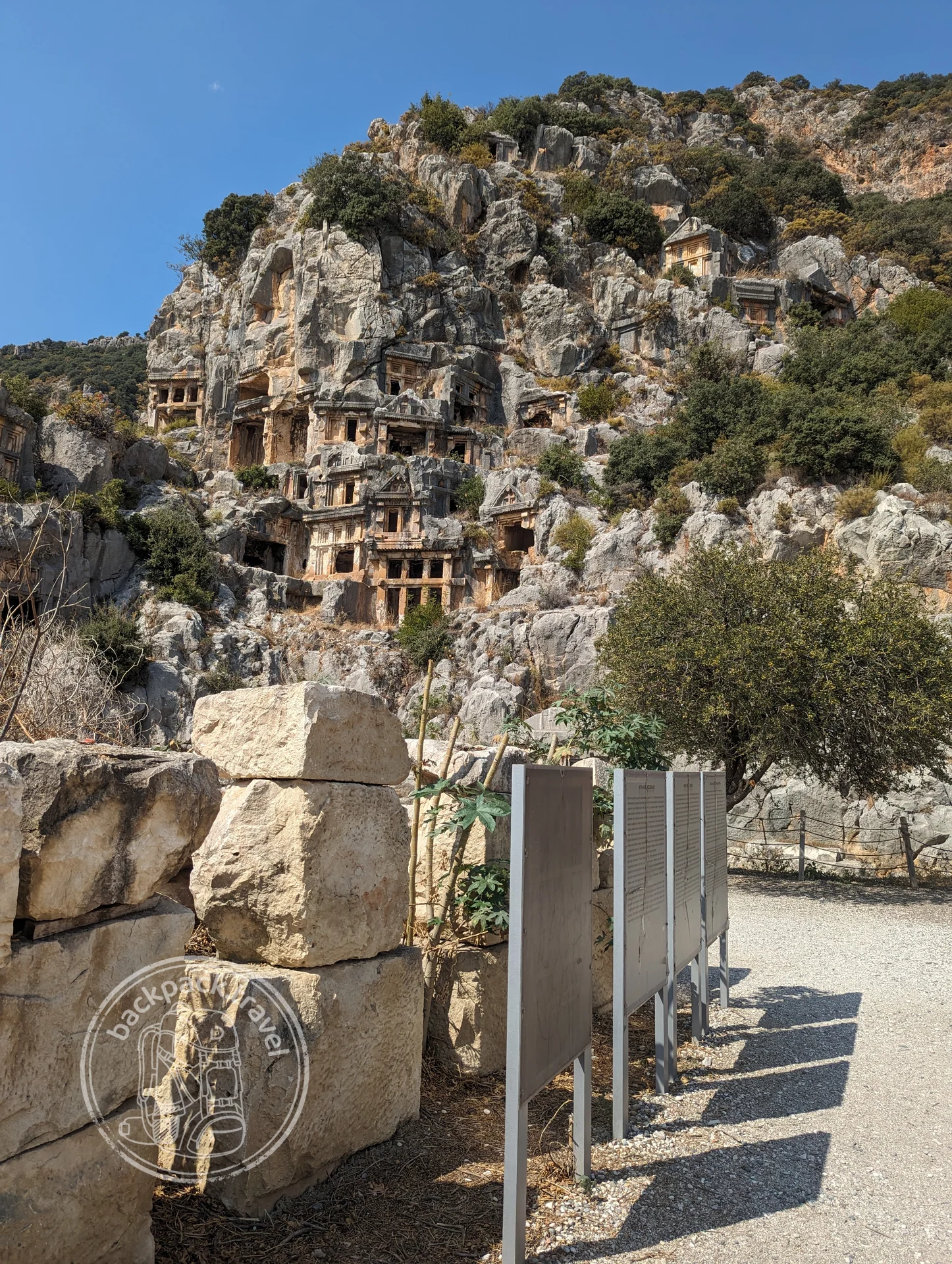
Ancient City of Myra
Myra was one of the main cities of Lycia and lies by modern Demre, two kilometres from the sea.
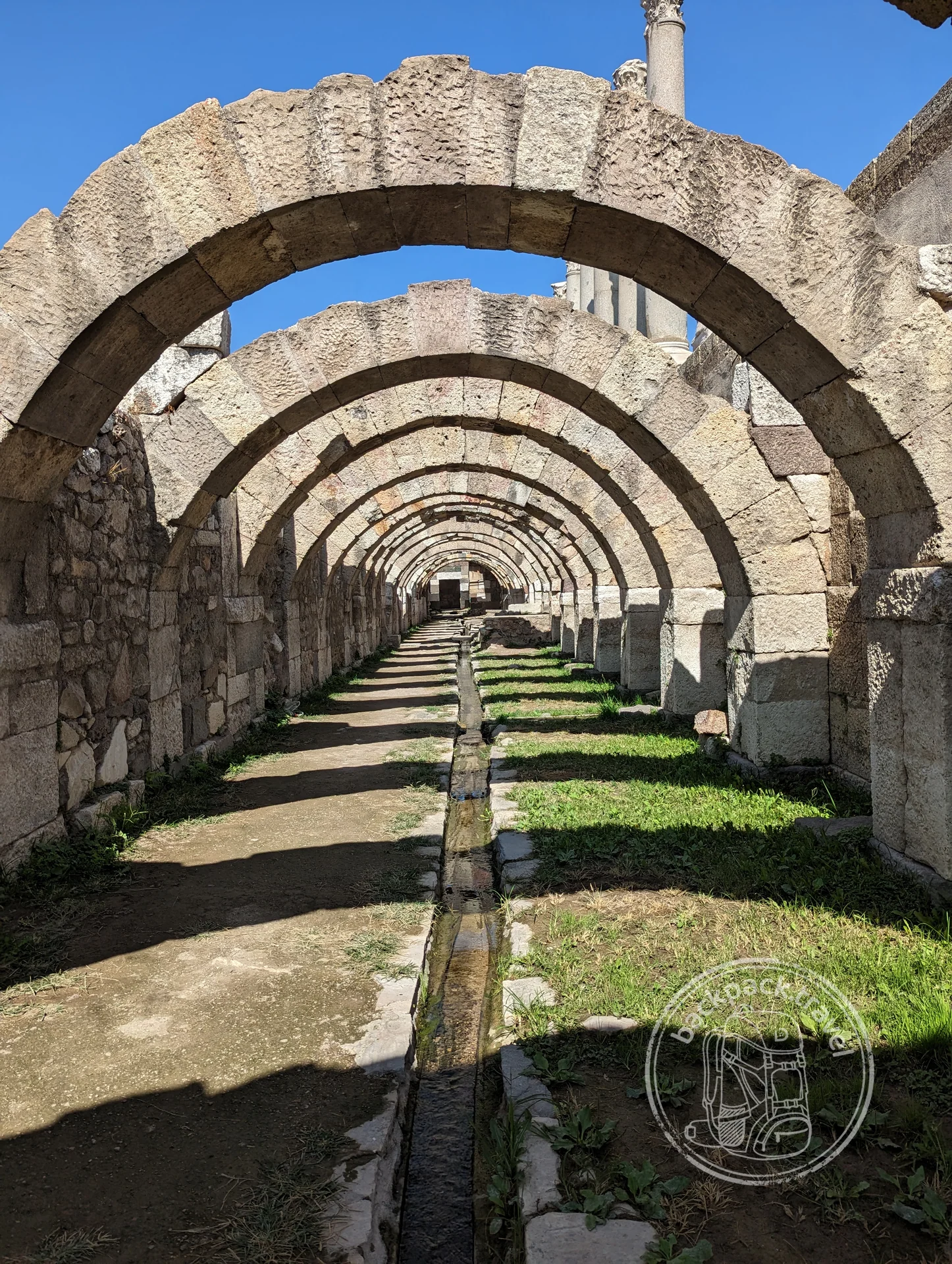
Agora of Smyrna
The Agora of Smyrna lies in the centre of İzmir, in the Namazgâh quarter, and remains one of the few surviving public squares of the ancient city…
Hellenism in Anatolia ended not with a battle but with paperwork: in 25 BC Augustus made Galatia a province, and the client kingdoms held on each as long as it could: Cappadocia until AD 17, Commagene until 72. The strangest monument of this layer lies on the summit of Nemrut Dağı. In the 60s–50s BC Antiochus I of Commagene heaped up a tumulus of gravel fifty metres high there and set statues of gods eight or nine metres tall around it, seating himself in the same row as Zeus and Heracles. The heads fell long ago and stand on the ground separately. What is inside the tumulus nobody knows: the gravel cannot be taken apart without it sliding down. Nemrut matters to me because it belongs on its real shelf. The guidebooks present it as an “ancient sanctuary”, and by its atmosphere that is true: 2134 metres, wind and heads looking at the sunrise. But by age it is a contemporary of Caesar, and from here there are still seven layers down to bedrock.
In those same years, in 63 BC, Mithridates VI of Pontus died, Persian by blood and Greek by culture, who fought Rome three times and lost the last war; his ancestors cut tombs for themselves in the rock above Amasya. Lycia lived differently: from 168 BC twenty-three cities kept a league with proportional representation, which Montesquieu called a model of federation. You grasp the scale of Lycia at Andriake, the port of Myra: a museum of Lycian civilisations is open there in a Roman granary, and its map shows that ancient cities on this coast number not in the dozens but in the hundreds. On the Aegean shore they built on a grand scale: at Pergamon the Attalids raised an acropolis on the rock with a theatre on a sheer slope and an altar of Zeus, which was carried off to Berlin in the nineteenth century, and at Didyma the temple of Apollo was under construction for six hundred years from the end of the fourth century BC and was never finished.
In 278 BC Celts, the Galatians, came into the centre of the peninsula and settled around Ancyra; the Apostle Paul later wrote to them. In 323 Alexander died, his empire was pulled apart by his generals, and on the wreckage in Asia Minor kingdoms of its own grew up over a century and a half: Pergamon with a library second only to the one in Alexandria, Pontus, Cappadocia, Commagene. And in the spring of 334 BC he had only just crossed the Hellespont, beaten the Persians at the Granicus and, in winter at Gordion, cut the knot that nobody could untie.
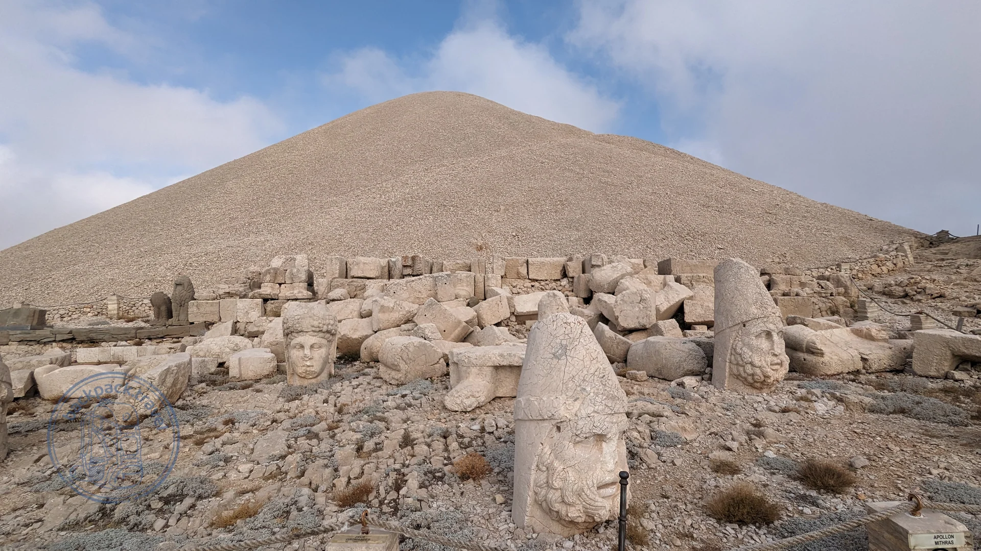
Mount Nemrut
A summit 2134 metres high on which, in the first century BC, King Antiochus the First of Commagene made himself a tomb and a sanctuary.
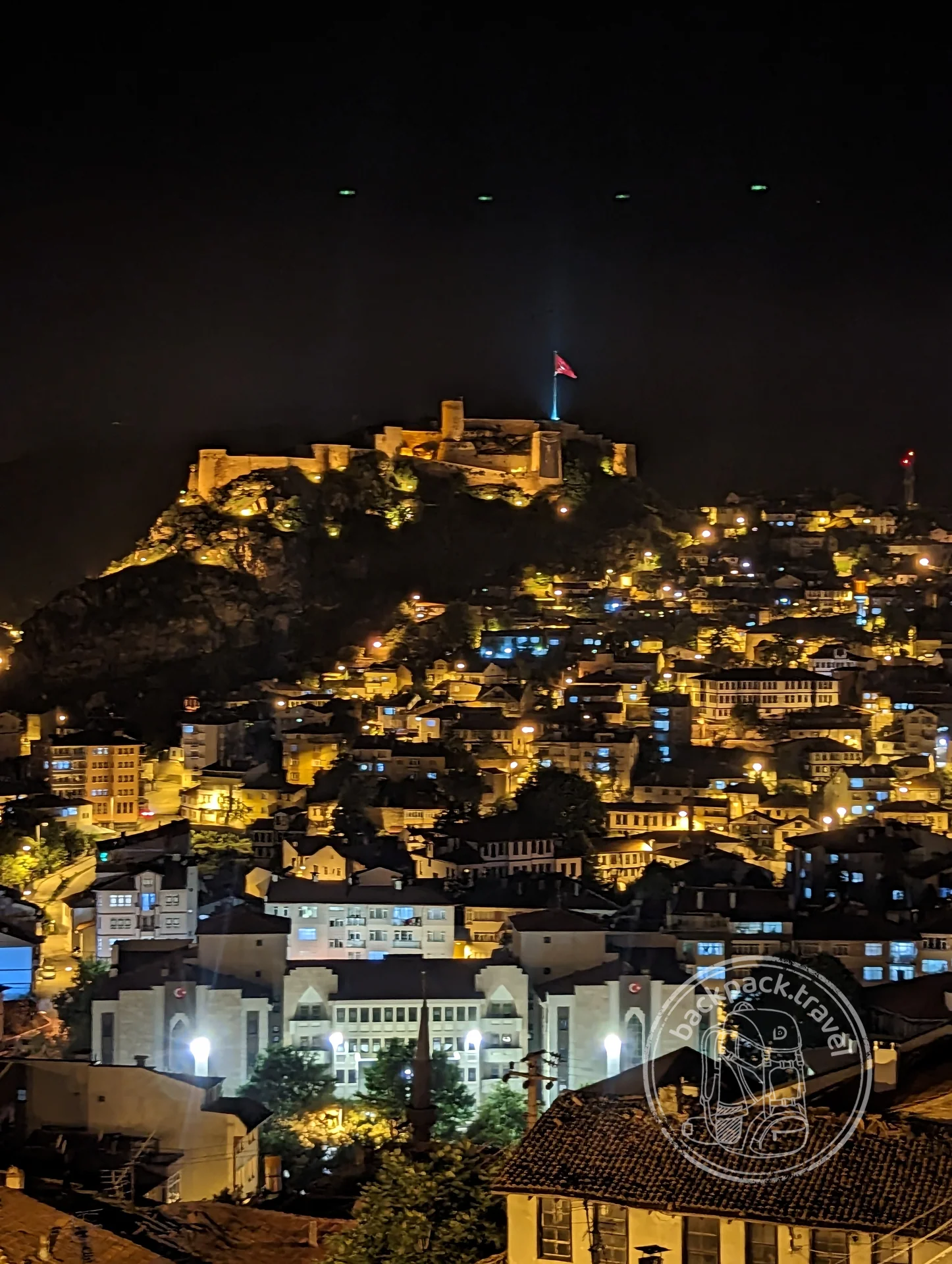
Amasya Castle and Rock Tombs
Above the Yeşilırmak river, in the sheer cliff right behind the old quarters, the tombs of the kings of Pontus are cut — the burial vaults of the Mithridatic dynasty…
Persian Anatolia began to end at the Granicus and ended in the same year that Miletus and Halicarnassus fell. For two hundred years before that the Persians held the peninsula by satrapies and by the Royal Road from Sardis to Susa: 2700 kilometres that couriers covered in a week. What is left of the Persians themselves is not architecture but infrastructure, though their subjects did build: the Lycian rock tombs above Myra, repeating wooden houses with their beams, and the temple façades of the tombs of Caunus were cut in the fourth century BC, under Persian rule, and at the same time, around 350, Priene was refounded on the rectangular grid devised a century earlier by Hippodamus of Miletus.
The Ionian Revolt of 499–493 BC, which ended with the destruction of Miletus, became the beginning of the Greco-Persian wars. And in the first years of the layer, around 540, this is what happened in Lycia. Harpagus, a general of Cyrus, laid siege to Xanthos. Herodotus writes that the Lycians, realising the city could not be held, gathered their wives, children, slaves and property into the acropolis, set it on fire, and went out to battle themselves and all died. The city was resettled, and five hundred years later it repeated the same thing when Brutus came. Today Xanthos is a hill with a theatre above the valley, and next to it Letoon, the sanctuary of Leto, the common shrine of the Lycian League; both are on one UNESCO listing.
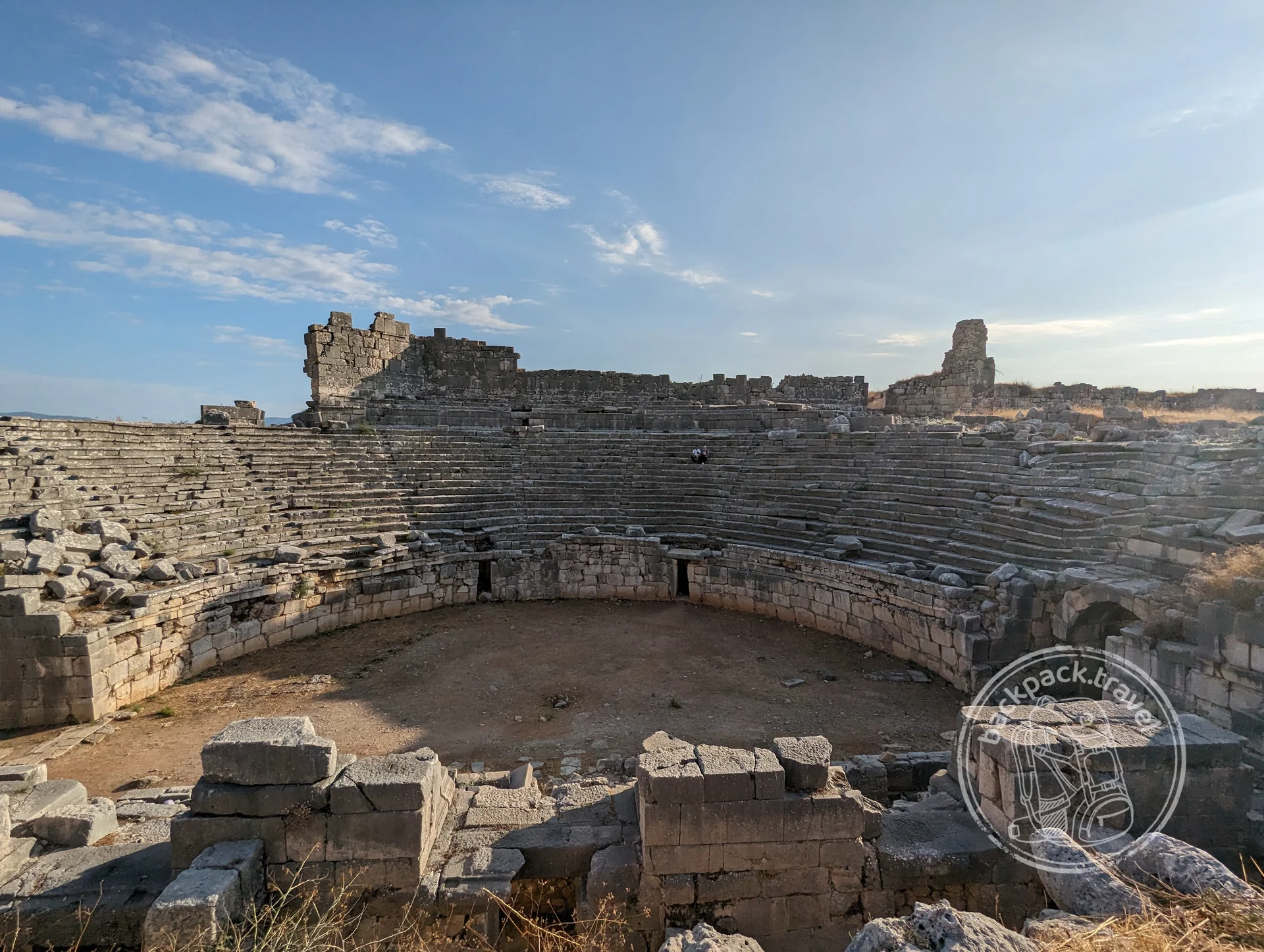
Ancient City of Xanthos
Xanthos was the largest city of Lycia and its capital, which is what an inscription found here says, calling it the metropolis of the Lycian people.
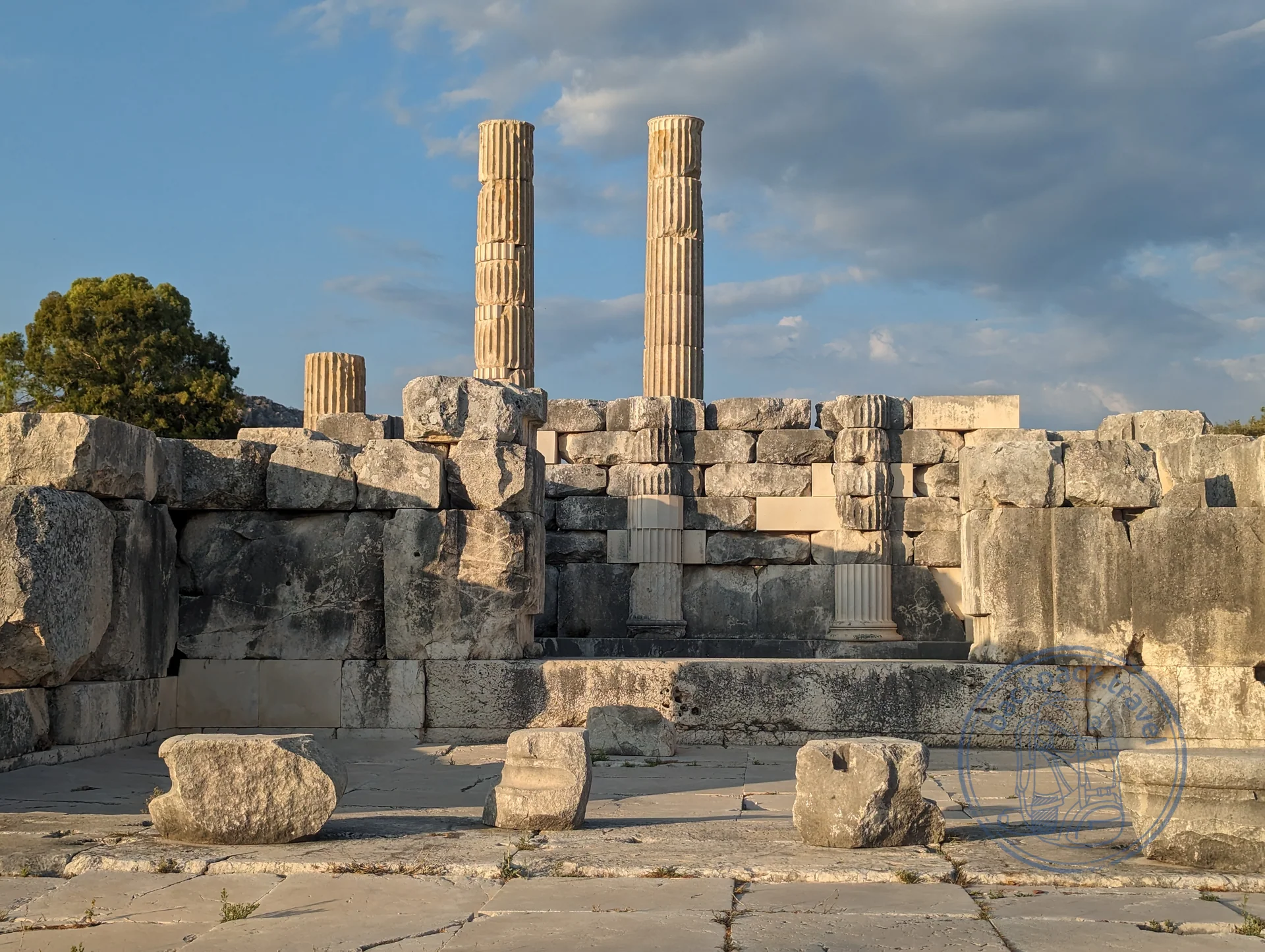
Sanctuary of Letoon
Letoon was the all-Lycian sanctuary and the federal centre of the league of cities; it lies four kilometres from Xanthos, right by the river floodplain.
Ancient City of Myra
Myra was one of the main cities of Lycia and lies by modern Demre, two kilometres from the sea.
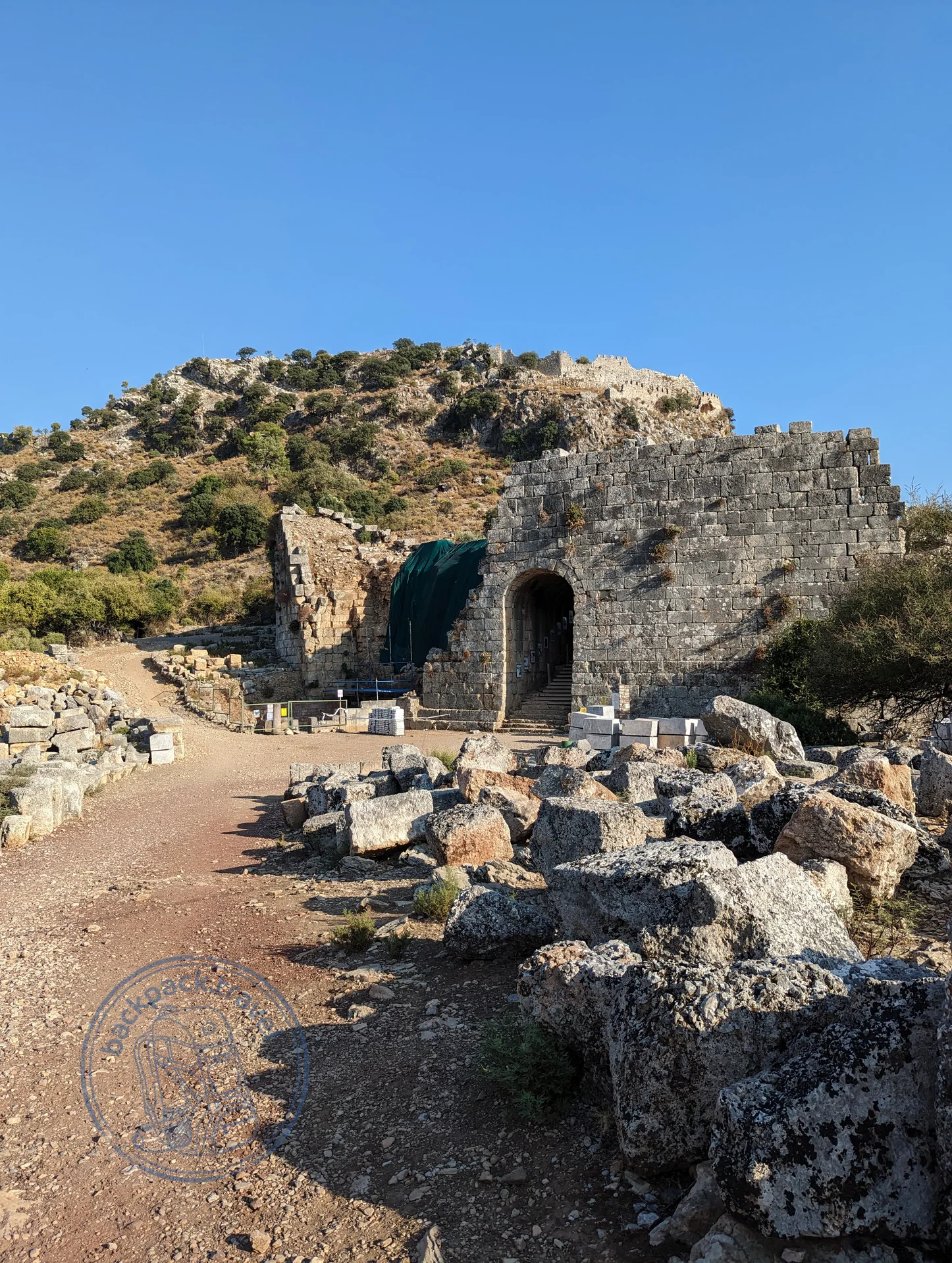
Ancient City of Caunus
Caunus stood on a rocky hill where the Dalyan river runs out into the sea and was a port until the bay turned into a delta with reeds and a sandbar.
Between the Persians and the collapse of the Bronze Age four worlds lived on the peninsula at once, not counting the Hittite splinters in the southeast, which have a chapter of their own below. I have gathered them into one chapter because they are contemporaries, and I go from the one that ended last.
Lydia perished last and left behind the most durable things. Croesus, who ruled until 546, switched the coinage to pure gold and silver, and “rich as Croesus” comes from there; he also paid for the columns of the temple of Artemis in Ephesus, and his name is carved on the base of one of them, the fragment now in the British Museum. The first coins of all, of electrum, the natural alloy of gold and silver, were struck at Sardis in the seventh century BC. The Ionian cities paid tribute to Lydia, and Phrygia it swallowed.
Urartu fell around 590 BC. Its capital stood on a rock above Lake Van: a rock more than a kilometre long, a fortress, cuneiform. Which of them finished Urartu off, the Medes or the Scythians, the sources do not say.
Phrygia ended around 700 BC, the date comes from the chronicle of Eusebius: the Cimmerians fell upon it, and Midas, according to Strabo, killed himself by drinking bull's blood. Midas was a real king, the Assyrians knew him as Mita of Mushki, and the tumulus at Gordion that is called Midas's is intact: 53 metres high, with a wooden burial chamber inside, the oldest surviving wooden structure in the world. It was felled around 740 BC, earlier than Midas came to the throne, so the man lying there is most likely his father. Archaeologists, meanwhile, date the great fire of Gordion to 800, still before Midas, so who burned the capital is disputed. The first levels of the underground cities of Cappadocia are also usually attributed to the Phrygians, though that is tradition and not a find; the Hittite version archaeology does not confirm at all.
Ionia did not perish, it simply was not a kingdom. The Greeks came to the coast around 1000 BC, and this is the Greece that people usually look for in Athens: philosophy was born at Miletus in the sixth century, Herodotus was born at Halicarnassus, Homer, by the most widespread version, at Smyrna. Inland the Greeks did not go: Phrygia and Lydia sat there.
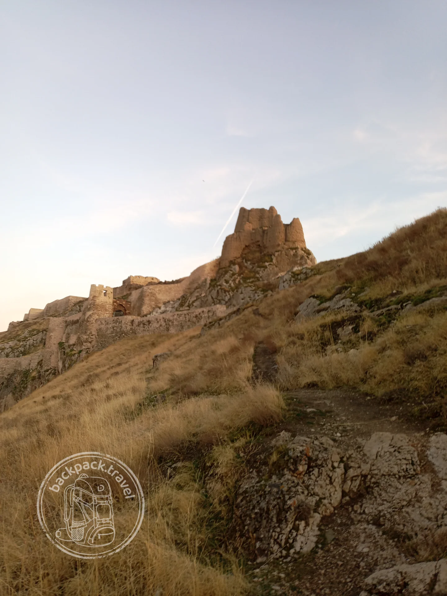
Van Fortress
Van Fortress — a rocky ridge more than a kilometre long on the western edge of the city: here in the ninth century BC stood Tushpa, the capital…
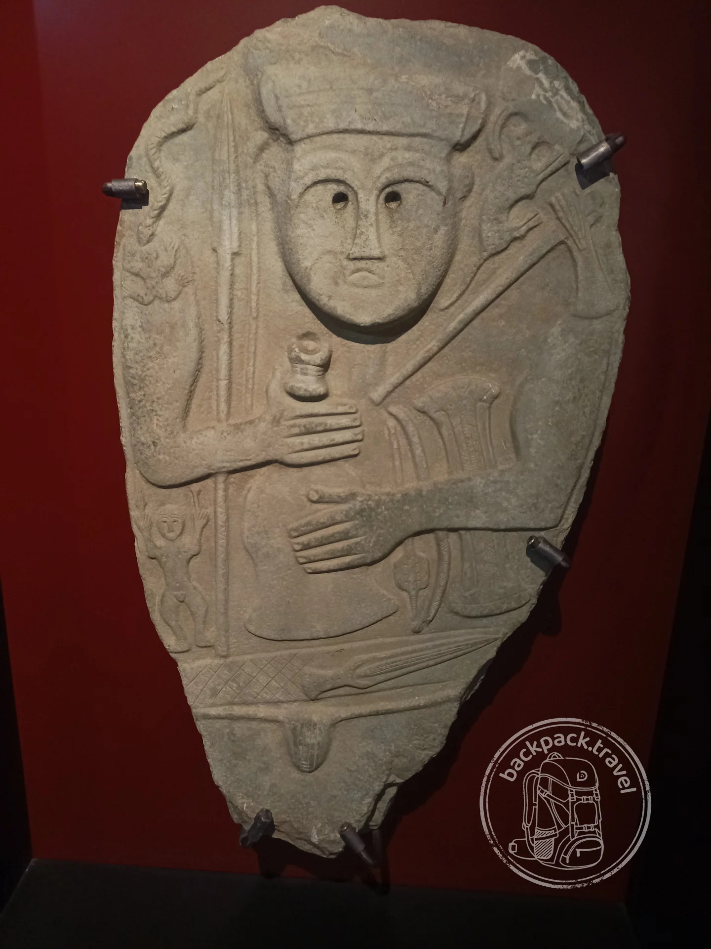
Van Museum
The Van Museum, opened in a new building at the foot of Van Fortress, holds the world's main collection on the kingdom of Urartu — a state…
Assyria swallowed the last Hittite kingdoms one after another: Kummuh in 708 BC, Melid at Arslantepe in 712, Carchemish in 717. These were splinters in the southeast, with Luwian writing and lions at their gates, and they outlived the mother country by almost five centuries.
The mother country ended around 1200 BC: Hattusa was first abandoned, then it burned, the empire collapsed together with half of the Bronze Age world, and the guilty are still appointed to taste: drought, the “Sea Peoples”, the Kaskians. Half a century before the collapse, at the sanctuary of Yazılıkaya two kilometres from the capital, a procession of more than six dozen gods walking towards one another was carved along the walls of the gorge. Earlier still, after the battle of Kadesh in 1274 BC, the Hittites and Egypt signed a peace treaty, the only ancient one to survive in the versions of both sides: the tablet is in Istanbul, a copy hangs in the United Nations building. In the Great Temple of Hattusa lies a green stone, a smooth block of nephrite or serpentine; it is called a gift from Ramesses II in honour of the peace, and that is folklore, but the treaty was real.
Hattusa lies in the steppe near Çorum, and that steppe is itself a dig: among the fields stand solitary hills of regular shape, those same tells, and only a small part of them has been opened. Hattusa is 180 hectares of walls and foundations, the Lion Gate, the King's Gate, the Yerkapı rampart with a tunnel under it, and estimates of the population range from ten to fifty thousand, and even the lower one, for the thirteenth century BC, means an enormous city. Everything of value found in it has been carried off to museums, so what remains on the spot is stones and scale, and it is for the scale that people come here.
The Hittites had lived in Anatolia since the twentieth century BC, their names already stand in the tablets of Kültepe, but the empire began around 1650, when Hattusili I made Hattusa his capital and took his name from the city: “the man from Hattusa”. The country had been called Hatti before him too.
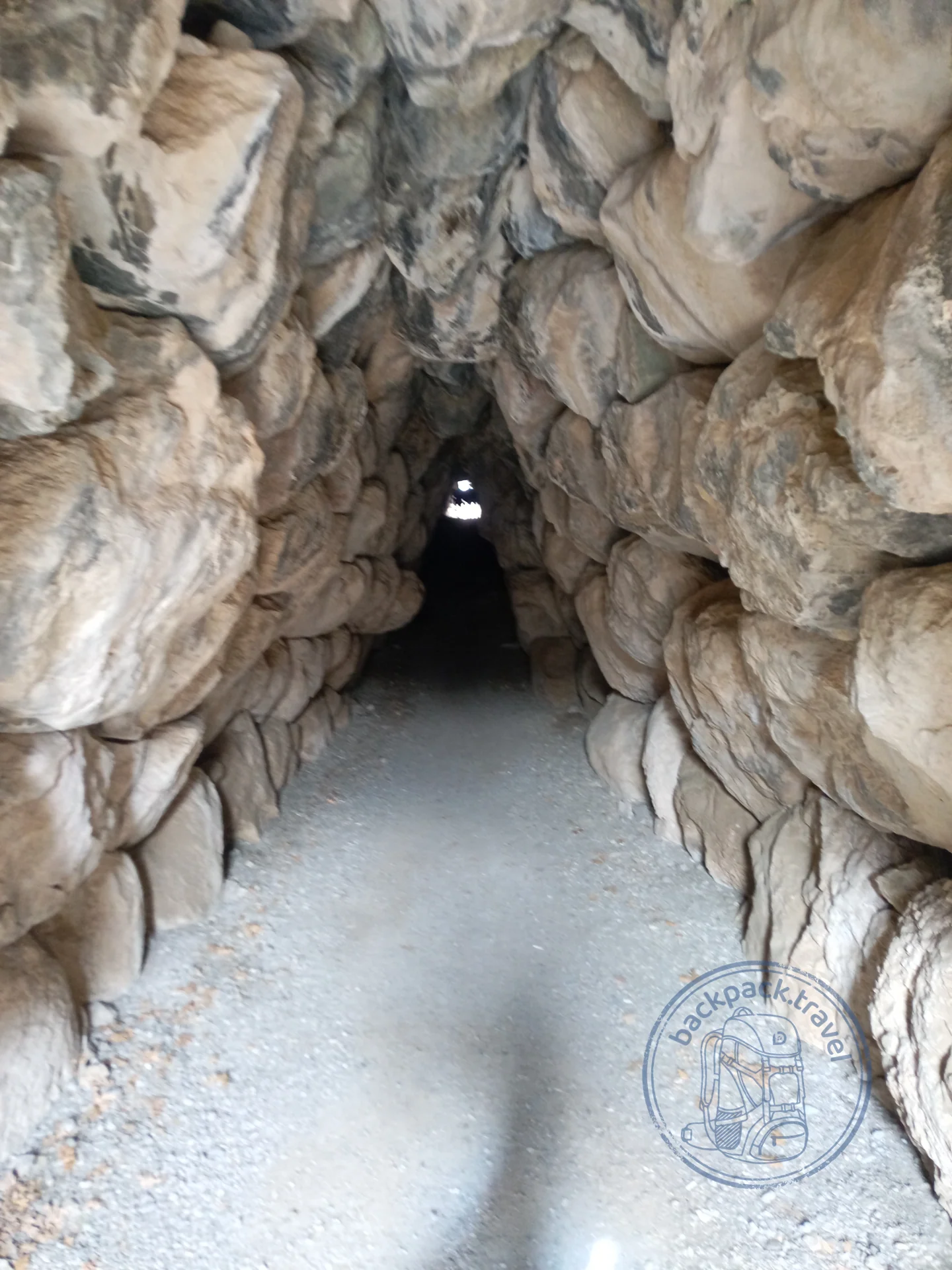
Hattusa
The capital of the Hittite kingdom, which stood on the Anatolian plateau by the present-day village of Boğazkale — a city that in the fourteenth century BC…
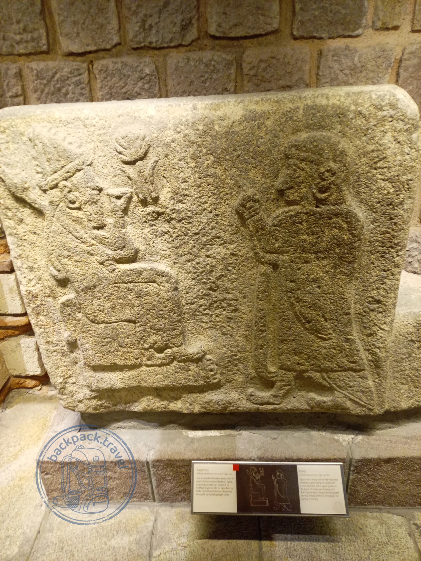
Museum of Anatolian Civilisations
A collection worth stopping in Ankara for, even if the capital was not part of the plan: laid out here is the whole prehistoric and ancient…
The Hattians did not dissolve into the Hittites quietly: around 1700 BC Anitta, king of Kussara, took Hattian Hattusa, razed it and cursed anyone who would settle the hill; half a century later Hattusili I sat down on exactly that spot. The last thing the epoch left on the surface is letters. The Assyrian trading colony at Kültepe near Kayseri, founded around 1950 BC, burned twice, around 1720 and, earlier, around 1835, and in both fires the clay tablets survived, 23 thousand in all: contracts and complaints about partners. These are the earliest texts of Anatolia; writing was brought here not by the Hattians and not by the Hittites but by merchants, and in these tablets Hittite names occur for the first time.
Forty kilometres from Hattusa, at Alacahöyük, beneath the Hittite layers next to the Sphinx Gate, archaeologists in the 1930s found thirteen royal tombs, fourteen by other counts, a thousand years older than the gate, of the twenty-fifth to twenty-third centuries BC. These are the Hattians, a people with a language like nothing else known. In the tombs lay bronze sun discs and standards with deer, which now stand in Ankara; the sun disc from there was the emblem of Ankara in 1973–1995 and has remained its unofficial symbol. The excavations began on Atatürk's personal order: the young republic needed a history older than the Greeks.
Troy at the other end of the peninsula runs through all the layers of the Bronze Age. The hill of Hisarlık by the Dardanelles is nine cities one on top of another: Homeric Troy, the sixth and seventh layers, a contemporary of the Hittite empire, which knew it as Wilusa; the second layer, where Schliemann found “Priam's treasure”, a thousand years older than any Trojan War; and the first Troy, founded around 3000 BC. The hill is hard to look at, Schliemann mixed up the layers with his trench, but the Troy museum of 2018 is the best on the Aegean coast.
Around 3000 BC the palace on the hill of Arslantepe near Malatya burned down, and in its place another society arose, with a royal tomb and weapons in it. The palace had stood since 3300: corridors, wall paintings, seals, an administrative building of a kind the world did not yet have, and in it the first known swords, of arsenical copper. Here inequality is for the first time so clearly visible in the ground: some people have swords, the rest do not. The hill is called “the lion's” after the late Hittite lions at its gate: the top layer gave its name to everything beneath it. Since 2021 Arslantepe has been on the UNESCO list.
Below the palace, inside the hill, lie two thousand years of villages that were learning to smelt copper. That is the Chalcolithic, the copper-stone age, between the hoe and the state.
Çatalhöyük near Konya emptied around 5600 BC, having lasted a thousand five hundred years. By the old estimates five to ten thousand people lived in it, by the 2024 recalculation fewer than a thousand at any one time; there were no streets: the houses stood wall to wall, people walked over the roofs and climbed down inside through the smoke hole. The dead were buried under the floor, bulls were painted on the walls. James Mellaart excavated it in 1961–1965, Ian Hodder dug for another twenty-five years.
The main find sits in Ankara: a clay woman on a throne with leopards at her sides, around 6000 BC. She is worth a separate trip to the museum. In this image, a woman between two beasts, it is customary to see the ancestor of the Hittite, Greek and Roman goddesses; continuity cannot be proved, but the image is eight thousand years old and recognisable at first glance.
Earlier still Europe left Anatolia: analysis of ancient DNA has shown that the first farmers of Europe are descendants of Anatolian farmers of the same horizon, only from the northwest of the peninsula, and around 6500 BC they crossed the Aegean Sea.
Çatalhöyük was founded around 7100 BC, and it was not founded from nothing: it had ancestors, and they are in the next layer.
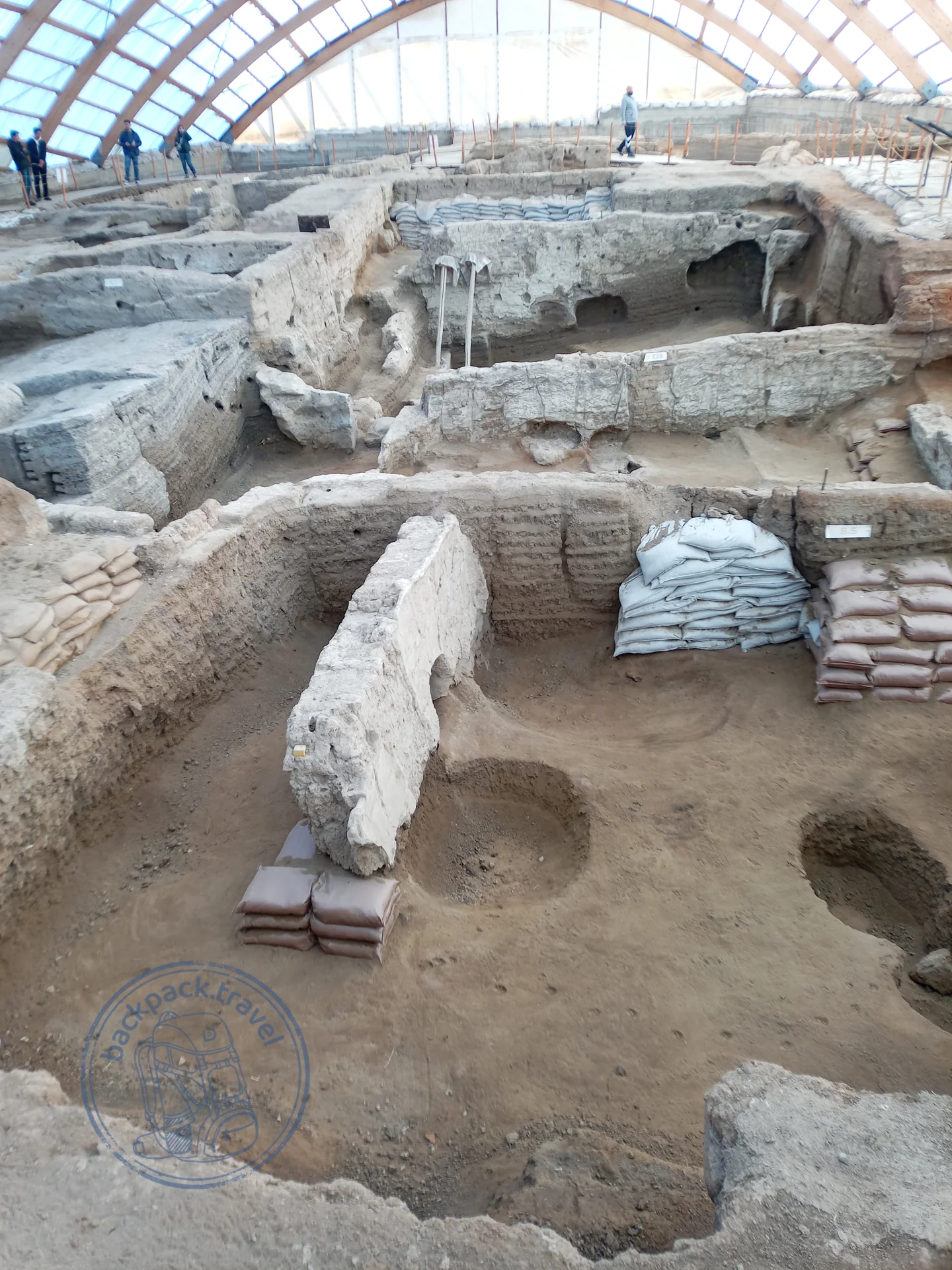
Çatalhöyük
Çatalhöyük — one of the oldest cities on the planet and a UNESCO World Heritage site an hour's drive southeast of Konya.
Museum of Anatolian Civilisations
A collection worth stopping in Ankara for, even if the capital was not part of the plan: laid out here is the whole prehistoric and ancient…
The top of this layer is the first villages, still without pottery. Aşıklı Höyük in Cappadocia lived from 8200 to 7400 BC; Boncuklu Höyük ten kilometres from the future Çatalhöyük, around 8300, where the houses are still oval and the people are already trying to sow without giving up hunting; Çayönü near Diyarbakır from 8600, where by the eighth millennium they kept pigs and forged copper beads, its finds in the museum of Diyarbakır; Nevalı Çori near Şanlıurfa, where T-shaped pillars just like those at Göbekli stood inside the village, until a reservoir flooded it in 1992, and the cult building was reassembled in the museum of Şanlıurfa.
By 8000 BC the hill of Göbekli Tepe had been abandoned, and over ten thousand years it was covered with earth, deliberately or by landslides, until Klaus Schmidt began to dig it in 1995. Schmidt died in 2014, a small part of the hill has been excavated, and his conclusion changed the textbooks: first came the temple, then the city. Göbekli Tepe was long taken for a pure sanctuary to which people came to pray from the villages around, but since the 2020s dwellings and water cisterns have been found there as well; sanctuary and village, it seems, were not separate.
Without context Göbekli Tepe is a heap of stones. With context every slab can be read: the fox on a pillar, the snakes running down the edges, the hands folded on the belly of the central pair in enclosure D. Schmidt's book has been published in English, and it is best read before the trip. Start with the museum in Şanlıurfa: there is a full-size replica of an enclosure there and the “man from Urfa”, the oldest known life-size statue of a human being.
Karahan Tepe, 46 kilometres to the southeast, has been excavated only since 2019: more than 260 pillars, a chamber cut into the rock with eleven phallic columns and a head looking out of the wall. There are no barriers there, the pillars stand an arm's length away, and the stones sticking out of the ground all over the hill are unexcavated pillars, and how many there are nobody has yet counted. Karahan matters more than Göbekli: here dwellings have been excavated in whole quarters, and it was precisely from here that the pretty version collapsed, the one in which the temples were built by nomads who came to pray and went away again. What they considered a temple and what a house, nobody yet knows.
All of it was laid down around 9500 BC. People who knew neither farming, nor pottery, nor the wheel set limestone T-shaped pillars in a circle, up to five and a half metres high and up to ten tonnes in weight, with reliefs of foxes, snakes, boars and scorpions. Stonehenge is six thousand years younger.
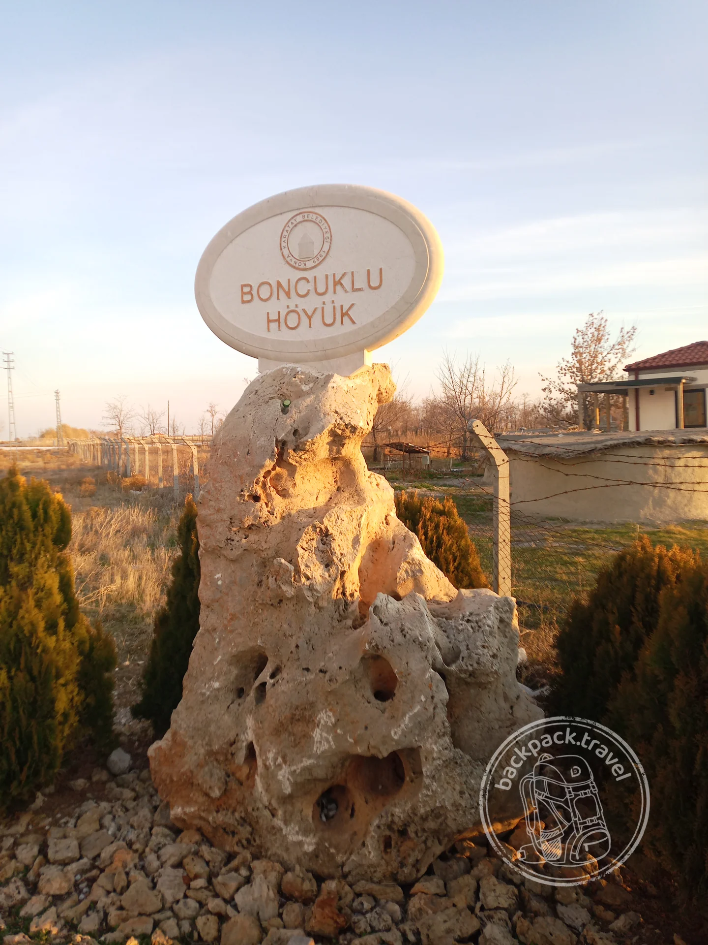
Boncuklu Höyük
Boncuklu Höyük — a small mound by the village of Hayıroğlu nine kilometres from the famous Çatalhöyük, where archaeologists are excavating a settlement…
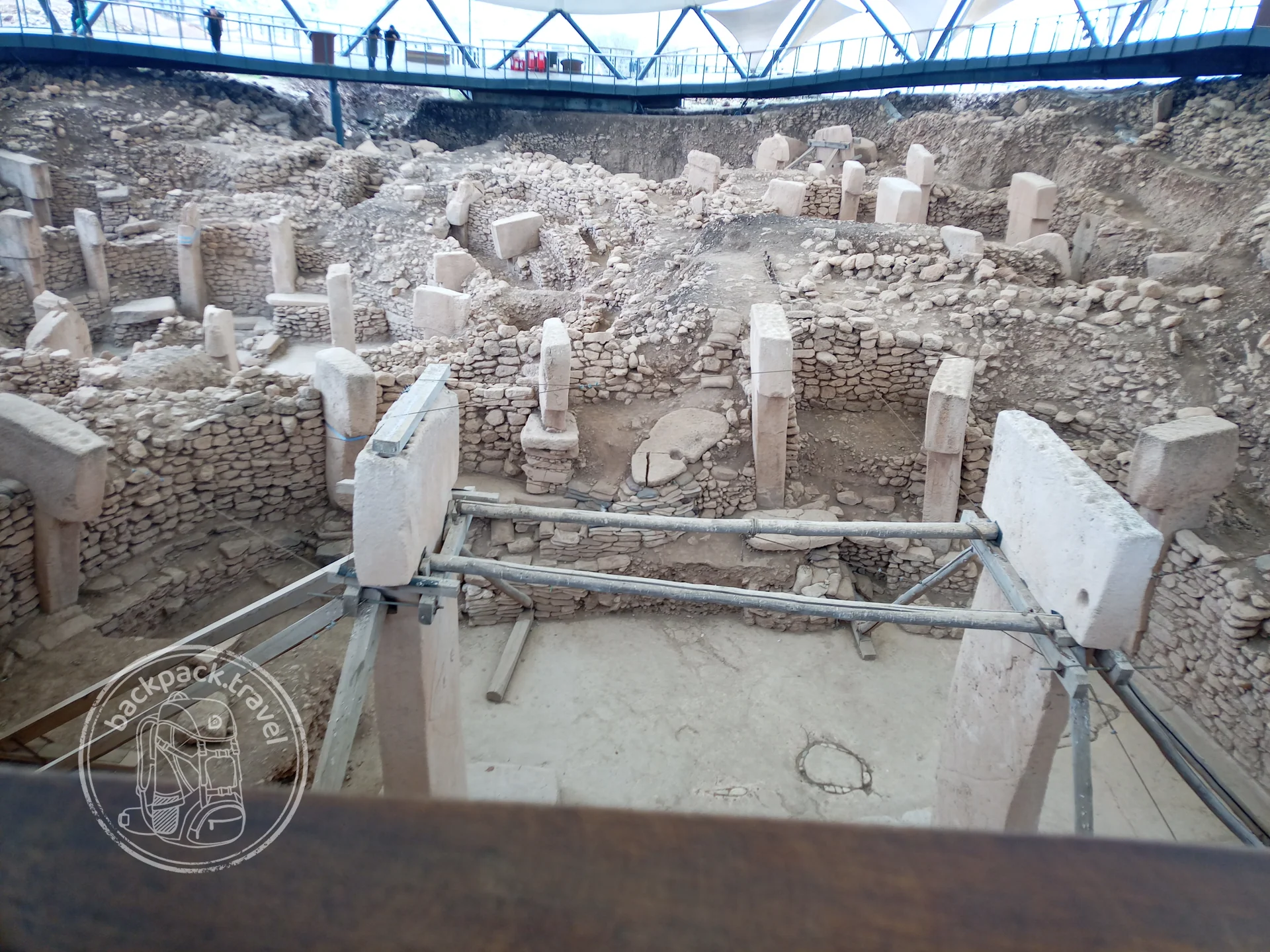
Göbekli Tepe
Göbekli Tepe — the oldest known monumental complex on the planet: its T-shaped limestone pillars were dug into the hill around 9600…
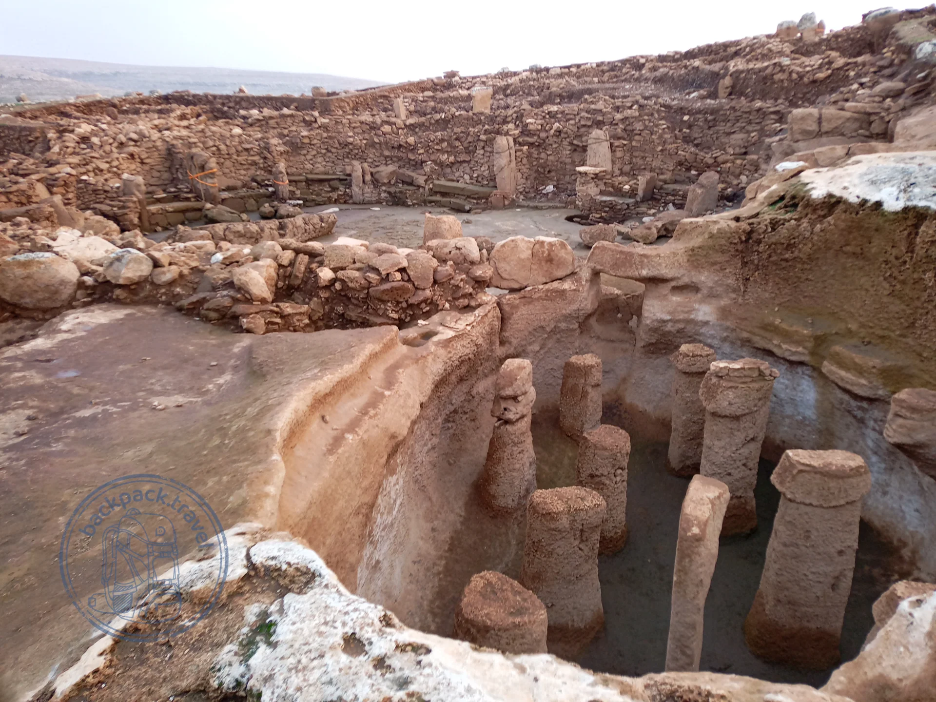
Karahan Tepe
Karahan Tepe — the younger brother of Göbekli Tepe, whose excavation began only in 2019 and at once produced a sensation: the rooms here are not…
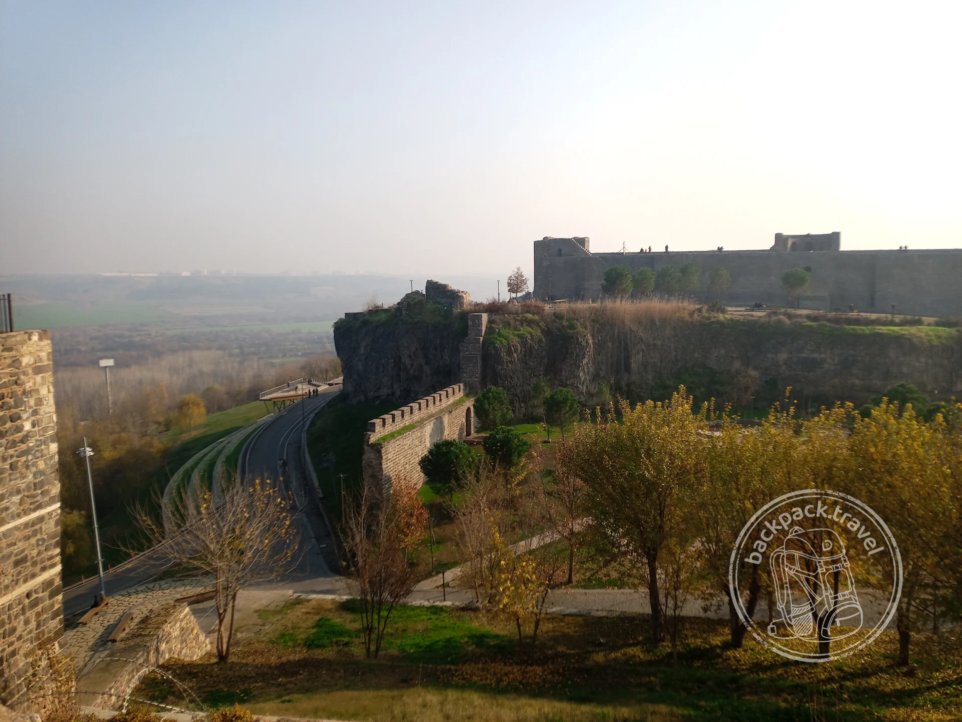
İçkale Citadel in Diyarbakır
İçkale — the “inner fortress” of Diyarbakır, a fortified hill in the northeastern corner of the city walls, where the city began: here stood…
Conclusion
Thirteen layers, and not one of them begun on empty ground. The Alaeddin Mosque in Konya stands on columns taken from Roman and Byzantine buildings; over a millennium and a half Hagia Sophia was a cathedral, a mosque, a museum and a mosque again, without changing its walls; the Hittites took from the Hattians the name of the country and its gods; and the sanctuaries of Göbekli Tepe have come down to us only because they ended up buried. In Anatolia a layer does not erase the previous one, it stands on it and takes stone from it, which is why you cannot see a single epoch here in a pure form: at any point there is another dozen under your feet.
Hence a correction to the way Turkey is usually seen. Istanbul, Cappadocia and the coast seem like different countries not because they are different Turkeys, but because in each place a different layer comes to the surface: in Istanbul the upper ones, in Konya a middle one, in Çorum and Şanlıurfa the lower ones. The hill is one, and the most interesting thing about it is not the separate heads and walls but the way they lie on one another.
Up on top, meanwhile, the next layer is being laid: the new districts of Istanbul, the airport, the third bridge over the Bosphorus. In a few centuries it will lie over the republic just as the republic lay over the Ottomans, and someone coming down the same hill will start not with Taksim but with it. What will they find there, and what will they call our layer?
Comments
Log in to leave a comment
Nothing here yet. Be the first!